
Single map. Multiple uses.
We create Custom Maps with AI powered Wayfinding
We create interactive custom maps with AI powered digital Wayfinding for private venues, major events, venues and institutions — designed to reflect your space and enhance every visitor’s journey.
Branded Maps
What is a Custom Map?
If your location, venue or event is “Private” you most likely just have a location on Google Maps shown or an older satellite image from a very high level altitude.
You will then need to create a custom map to get a much more accurate and more detailed map. With a custom map you can also include digital wayfinding navigation within your venue, location or event.
AI Powered Wayfinding & real time analytics
Custom Maps with AI powered Digital WayFinding
Add the custom map we create easily across your website, at venue digital screens, and mobile apps, with the option to include smart AI powered wayfinding navigation for an enhanced user experience.
Custom Way Finding
Having built a solution to working out how to get to any event/facility/attraction to any other place, we then integrated this with the event planning “MyPlan” feature in the mobile app, so if you planned to see, for example:
- the Poodle Competition,
- a specific Wood Chopping heat,
- ride the Ferris Wheel,
- eat a Tornado Fry,
- and buy a Bertie Beetle Showbag,
the app can now plot your route out for you, taking into account the times of the Poodle and Wood Chopping events, the walking time between them, and show you a route from your current location to each of your planned destinations, including notification when you need to leave to arrive in time for time-specific events.
Mapping Solution
Using a combination of available satellite imagery, event planning and logistics documents, and site visits – we created a map of locations of all events, attractions, facilities, and all relevant/important locations (including things like road/path intersections and building entrances/exits) in the event precinct.
We also then mapped out all the walkable connections between each of these locations and it’s adjacent location. For this event we ended up several hundred location “nodes”, each with at least one and up to 6 or 7 (and occasionally more) adjacent nodes.
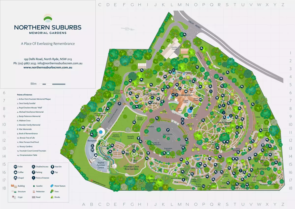
Case study
Navigating Sydney’s Royal Easter Show
Sydney Royal Easter Show is Southern Hemisphere’s largest family event attracting close to a million people in the two weeks during the show. The EasterShow venue is well mapped by Google/Apple maps, but for the duration of the event those maps, and the way-finding available from them would not work.
A section of normally open space is fenced in for the event blocking access except via 4 entries, and many of the internal roads and paths are blocked by things like ferris wheels, exhibits, food stands and other event-specific infrastructure. This means walking directions/distances between various places and events provided by the standard Apple and Google map SDKs are unusable.
Case study
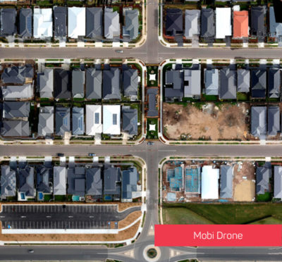
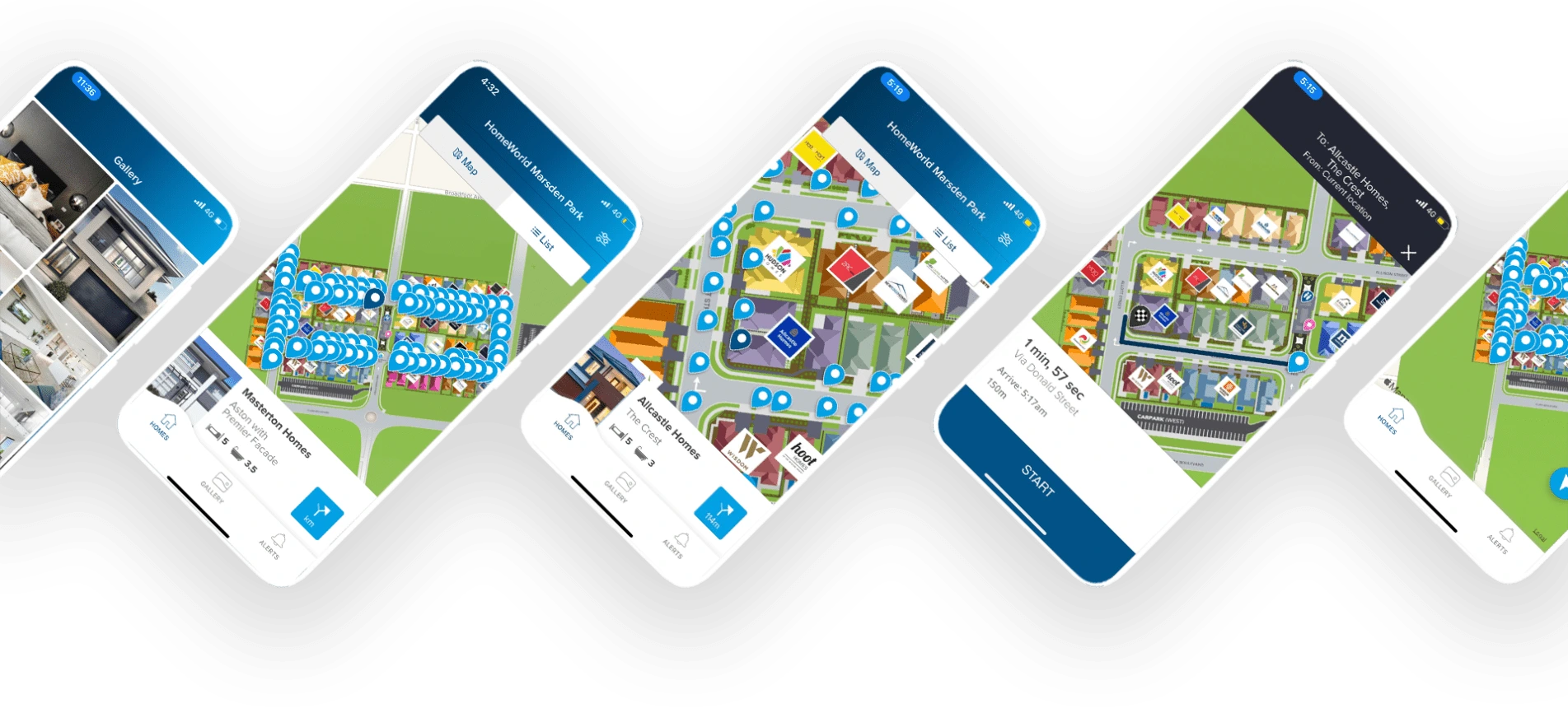
HomeWorld Marsden Park
HomeWorld display villages are usually in areas where existing road data and satellite imagery are not yet up to date. Even when accurate road data is available, the standard pedestrian wayfinding doesn’t meet best practice for family and child safety, routing pedestrians down the middle of roads, instead of along footpaths and using crossings or corners to cross roads.
There are also commonly other display village site specific constrains, for example often is a single builder has 2 or more display homes adjacent to each other, they’ll be fenced in and the entrance for all homes will be in one place – where Google/Apple maps will instead route you to the centre of the property boundary for each house.
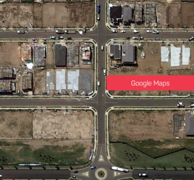
Google Maps Vs. Our Map
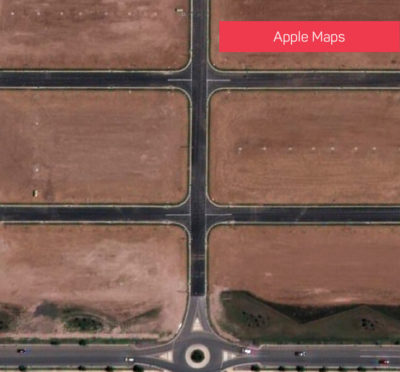
Apple Map Vs. Our Map
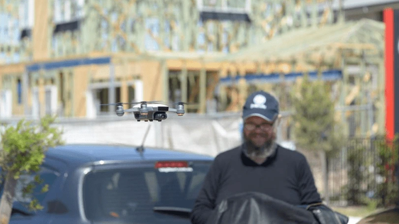
Combine drones and satellite photography
Custom Maps using Drones
When combining Mobiddiction’s drone aerial photography with high resolution satellite view imagery creating high resolution and more accurate points of interest (POI’s) we design a custom map for a much richer user experience, allowing for way-finding directions. All this managed from our platform to update in realtime.
Recommended for: Festivals, Events, markets, indoor venues, shopping centres, universities, educational institutions.
Frequently Asked Questions
What is a custom map with digital wayfinding?
A custom map with AI-powered digital wayfinding is a tailored digital map designed for private venues or locations. We use artificial intelligence to guide users through complex spaces with real-time directions and interactive navigation.
How does digital wayfinding improve navigation for visitors?
It simplifies movement through large venues by providing smart, real-time routes based on the user’s current location. This enhances visitor experience and reduces confusion compared to static maps.
Which industries or venues benefit most from custom map solutions?
Large venues such as universities, shopping centres, hospitals, and festivals benefit most. These environments often require precise, updatable navigation beyond standard public maps.
Can custom wayfinding maps be integrated into existing mobile apps or websites?
Yes, Mobiddiction’s custom maps can be embedded into websites, apps, or digital kiosks. This ensures seamless access for users without switching between platforms.
What are the steps involved in creating a custom digital map for a venue?
The process typically includes site mapping, defining navigation paths, tagging points of interest, and integrating the map into digital systems. Updates can then be made in real time as the venue evolves.
How does digital wayfinding differ from traditional static signage?
Digital wayfinding provides dynamic, interactive navigation with live updates. Unlike static signs, it can adapt instantly to changes such as new routes or temporary closures.
What features make Mobiddiction’s custom maps unique compared to standard mapping tools?
Mobiddiction’s maps are built from the ground up for each client, offering branded designs, accessibility routes, and live data integration. They deliver a more intuitive and engaging navigation experience for users.
Mapiddiction and Mobiconnect™ are platforms built and managed by the team at Mobiddiction Pty Ltd, a team working with Government and Enterprise programs since 2012.