Skip to main content
menu
Solutions
expand_more
Enterprise Platforms & Software
Business Software Solutions
Custom Enterprise Systems
Integration & API Services
GeoSpatial & Mapping
Digital Mapping & Wayfinding
Geospatial Data Analysis & Visualisation
Location Intelligence Platforms
Drones for Mapping
Venue & Indoor Maps
• Map Gallery
Immersive Tech (VR/AR/XR)
Training & Simulation
VR Experiences
• PatientVR
• RocketCrew
• VapingVR
Interactive Experiences
• Augmented Reality (AR)
• AR WayFinding
• AR Fan Engagement
AI & Consulting Programs
AI for Business
Technology Consulting
Automation & Intelligent Workflows
Resources
What are custom maps?
What is WayFinding?
Types of Custom Maps
Drone Mapping
Map Gallery
Products
expand_more
Powered by Mobiconnect™
PatientVR
Mapiddiction
Jobiddiction
Government
expand_more
Working With Government
Beach Safety
Forest Management
Recreational Fishing
Marine Management
Farming Support
State Forests
Surveying & Mapping
Whale Watching
Industries
expand_more
Enterprise Programs
Healthcare
Finance and Fintech
Memorial Parks
Events & Public Spaces
Sporting Venues
Rewards & Loyalty
Fisheries & Compliance
Retail & Customer Experience
Agritech & Farming
Case Studies
expand_more
Featured Programs
Our Work
Strategic Government Programs
GeoSpatial & Mapping Platforms
Immersive Tech Innovations
Enterprise Digital Transformation
Healthcare & Patient Outcomes
About Us
expand_more
Why us?
Our Approach & Strategy
Long Term Programs
Security & Compliance (ISO 27001)
Innovation and R&D
Enterprise Operations & Support
Team & Operations
Our Leadership Team
Careers
Solutions
strategy
Enterprise Platforms & Software
Business Software Solutions
Custom Enterprise Systems
Integration & API Services
Directions
GeoSpatial & Mapping
Digital Mapping & Wayfinding
Geospatial Data Analysis & Visualisation
Location Intelligence Platforms
Drones for Mapping
Venue & Indoor Maps
• Map Gallery
Simulation
Immersive Tech (VR/AR/XR)
Training & Simulation
VR Experiences
• PatientVR
• RocketCrew
• VapingVR
Interactive Experiences
• Augmented Reality (AR)
• AR WayFinding
• AR Fan Engagement
automation
AI & Consulting Programs
AI for Business
Technology Consulting
Automation & Intelligent Workflows
Resources
What are custom maps?
What is WayFinding?
Types of Custom Maps
Drone Mapping
Map Gallery
Featured
Memorial Parks
Easter Show
WayFinding
SharkSmart NSW
I want to build a new Product
Let's Talk
Products
cloud
Powered by Mobiconnect™
PatientVR
Mapiddiction
Jobiddiction
Featured
Components
I want to build a new Product
Let's Talk
Government
account_balance
Working With Government
Beach Safety
Forest Management
Recreational Fishing
Marine Management
Farming Support
State Forests
Surveying & Mapping
Whale Watching
Featured
Working with Government
I want to build a new Product
Let's Talk
Industries
cloud_done
Enterprise Programs
Healthcare
Finance and Fintech
Memorial Parks
Events & Public Spaces
Sporting Venues
Rewards & Loyalty
Fisheries & Compliance
Retail & Customer Experience
Agritech & Farming
Featured
Rewards & Loyalty
Fan Engagement
I want to build a new Product
Let's Talk
Case Studies
laptop
Featured Programs
Our Work
Strategic Government Programs
GeoSpatial & Mapping Platforms
Immersive Tech Innovations
Enterprise Digital Transformation
Healthcare & Patient Outcomes
Featured
Platform
Spatial
I want to build a new Product
Let's Talk
About Us
trophy
Why us?
Our Approach & Strategy
Long Term Programs
Security & Compliance (ISO 27001)
Innovation and R&D
Enterprise Operations & Support
groups
Team & Operations
Our Leadership Team
Careers
Featured
Our Expertise
About Us
I want to build a new Product
Let's Talk
call
1300 600 670
login
Login
contact_support
Contact Us
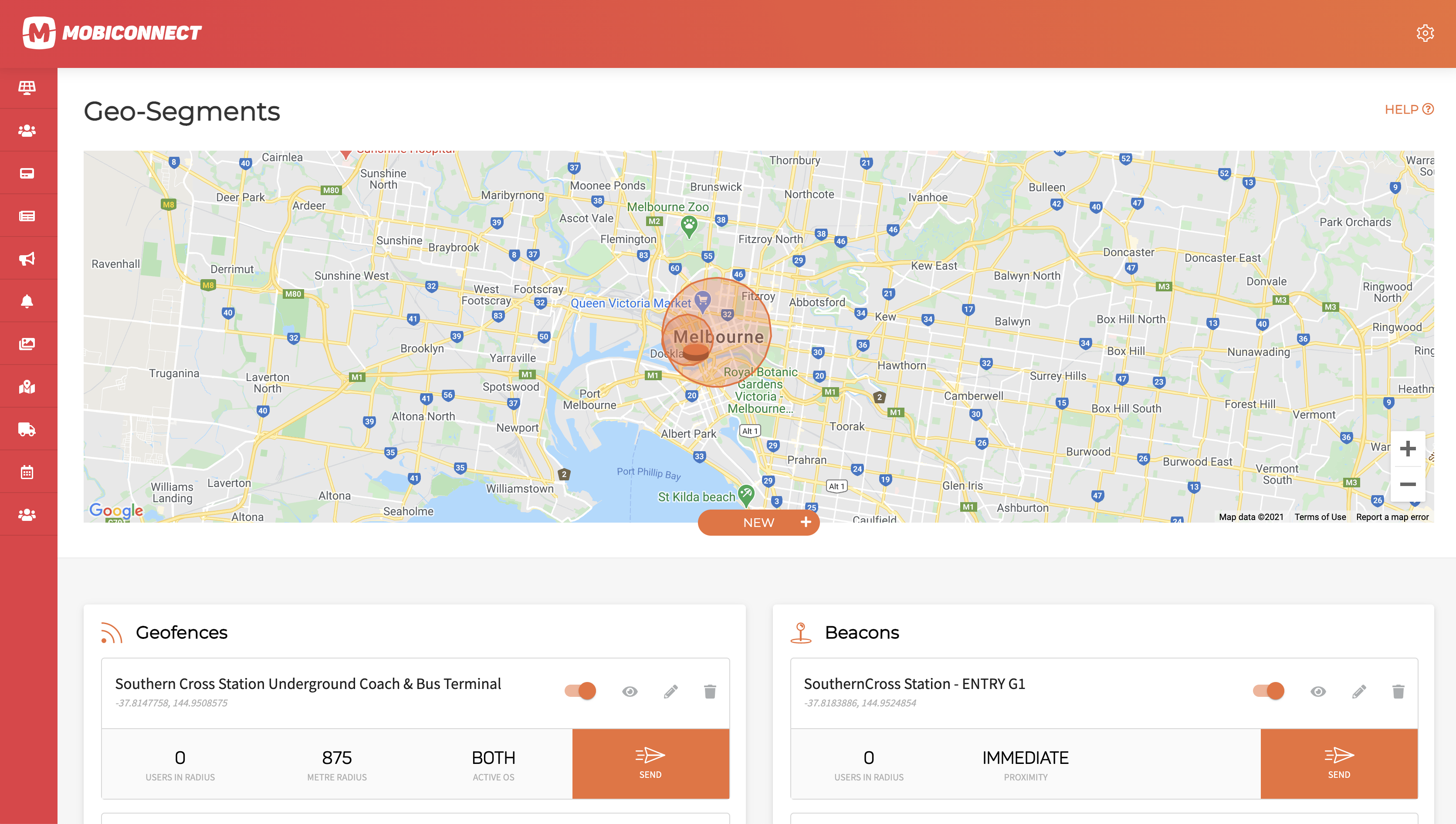
Map Gallery
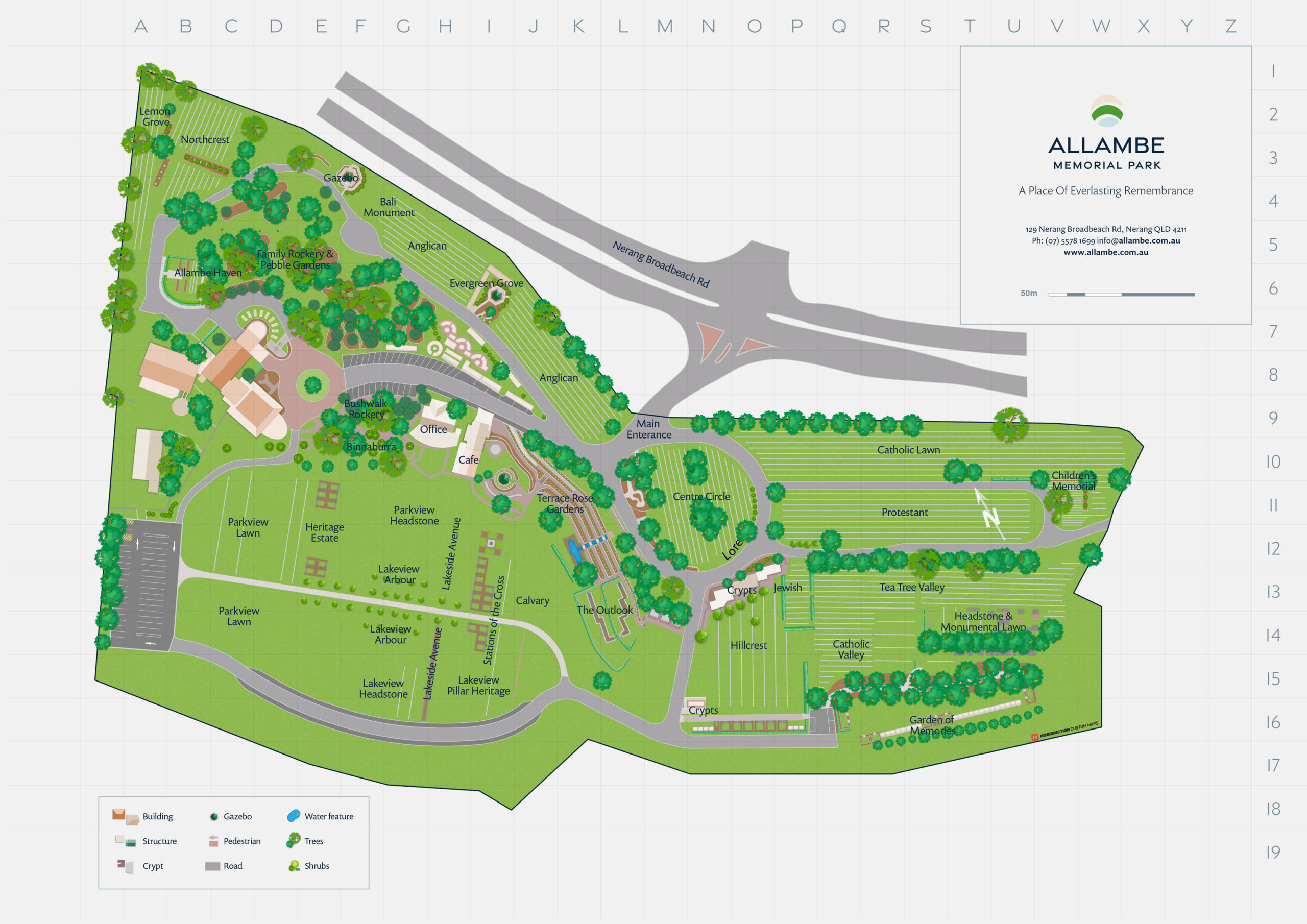
Allambe
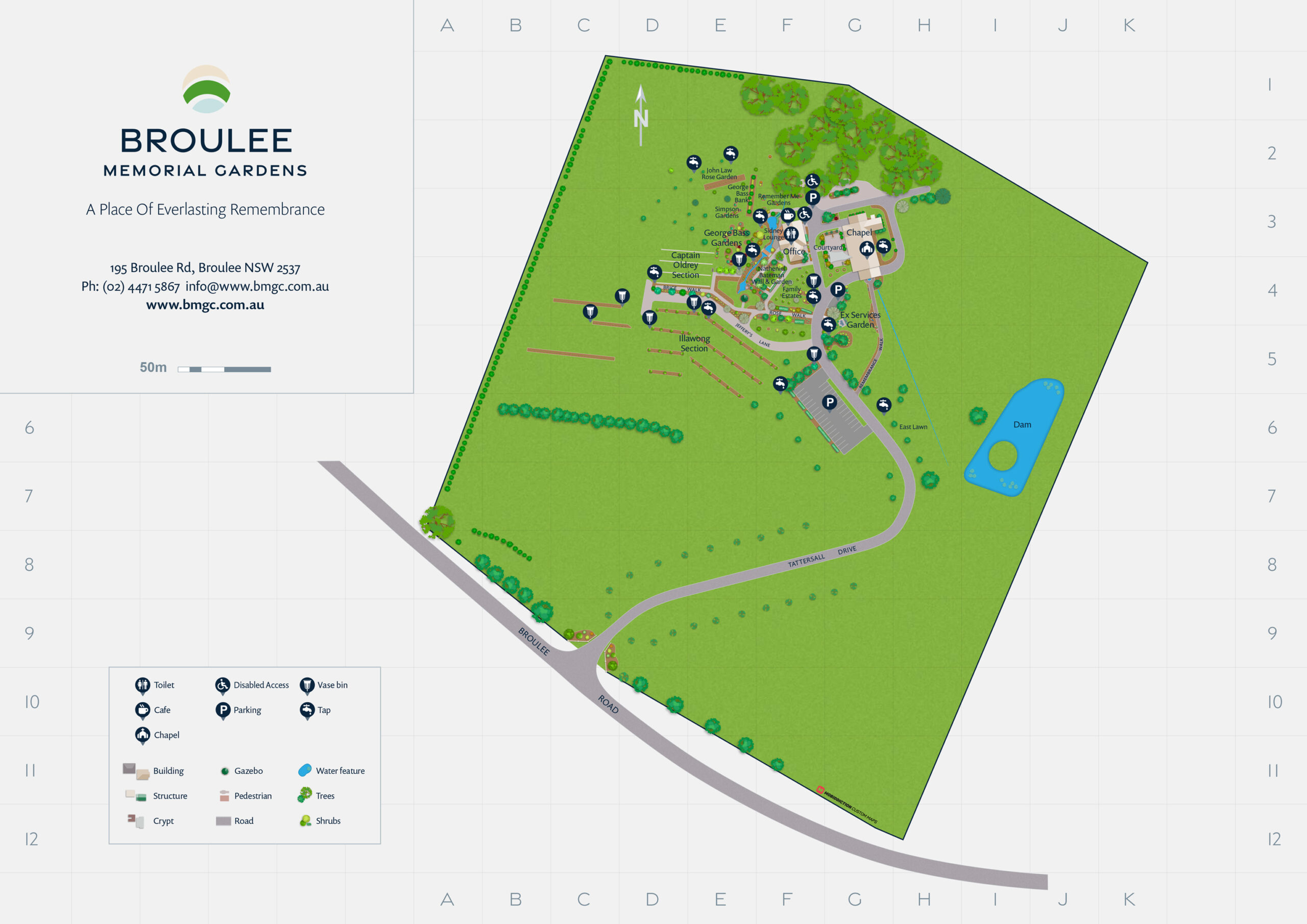
Broulee Memorial Gardens, A Custom Map from Drone Imagery
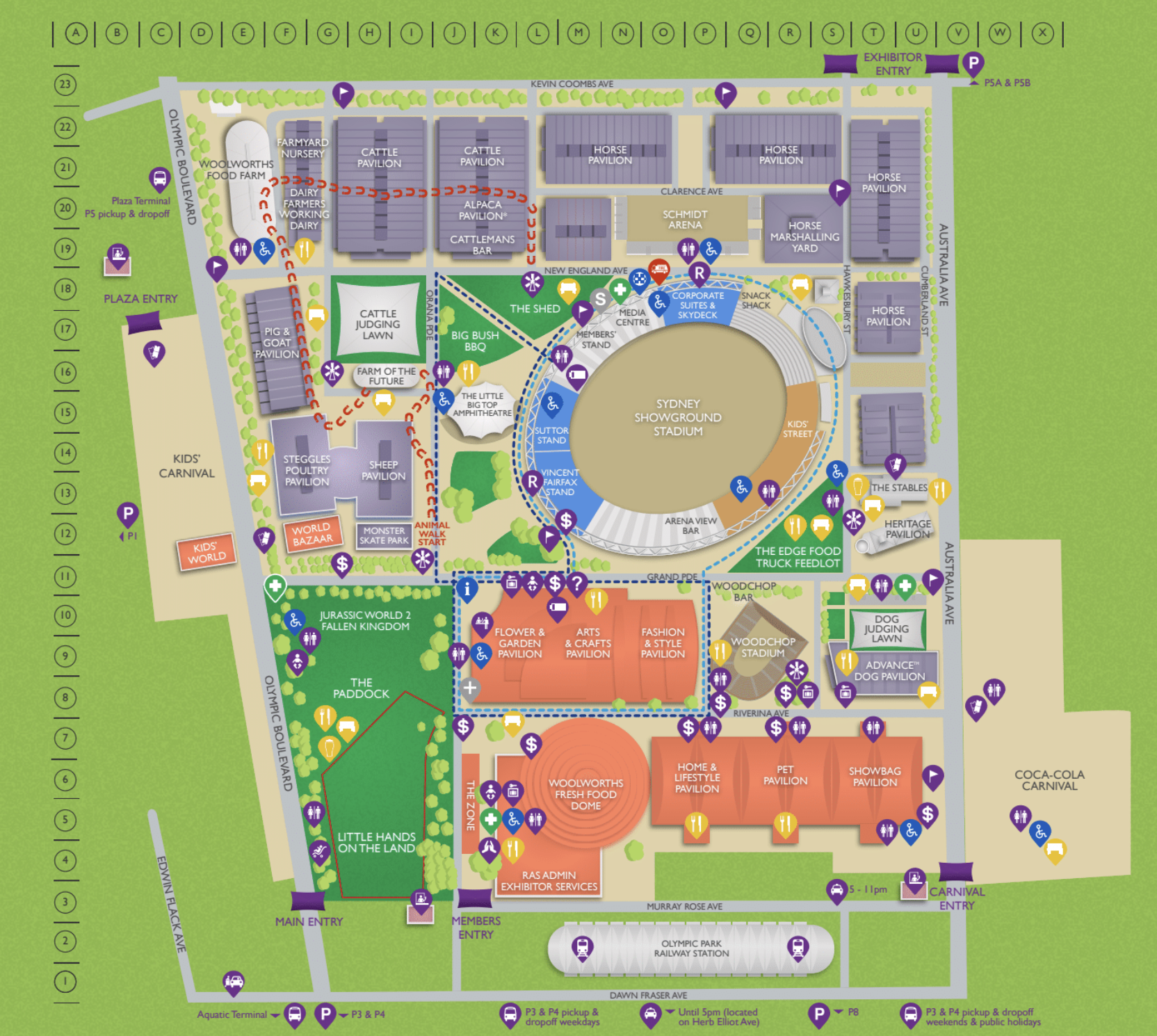
Sydney Royal Easter Show
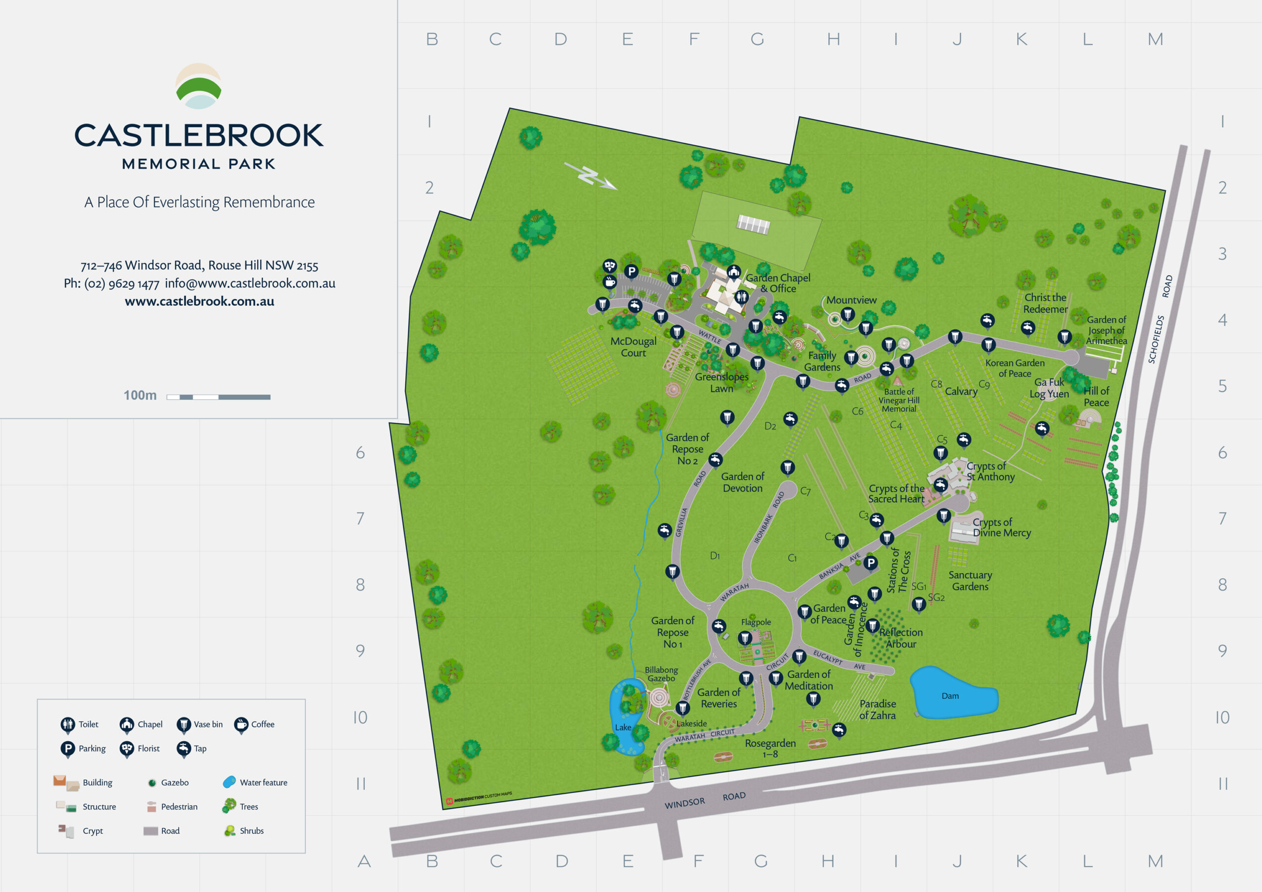
Castlebrook
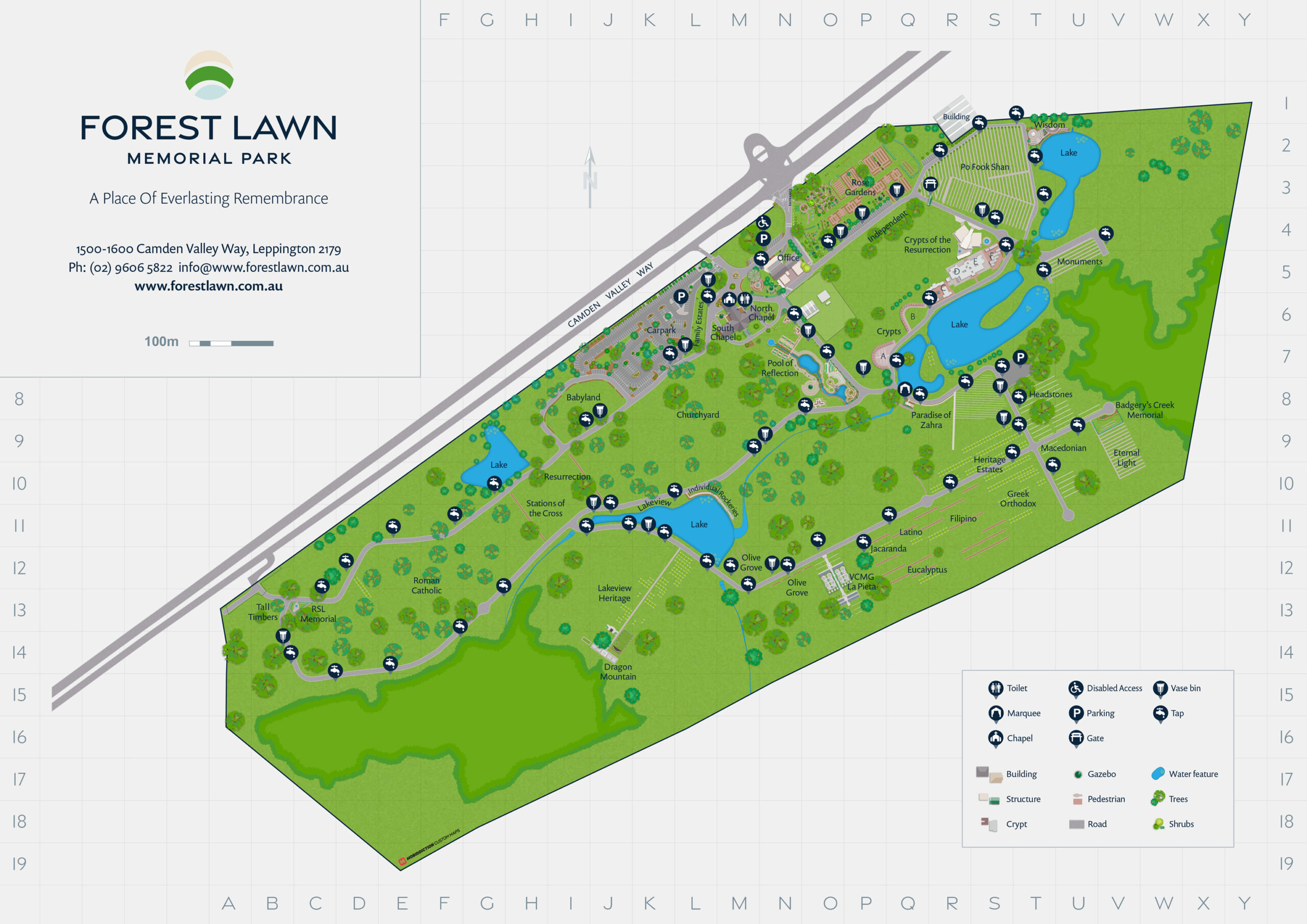
Forest Lawn
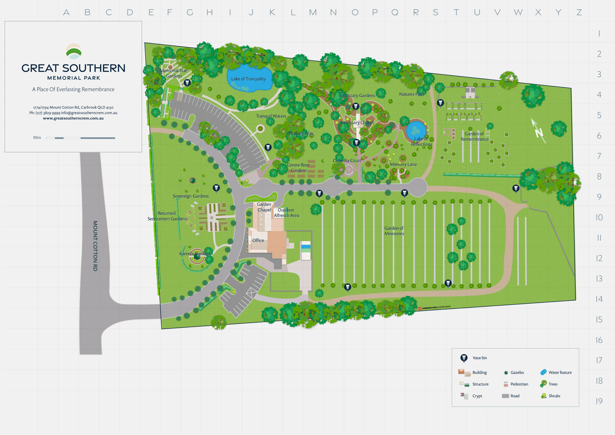
Great Southern
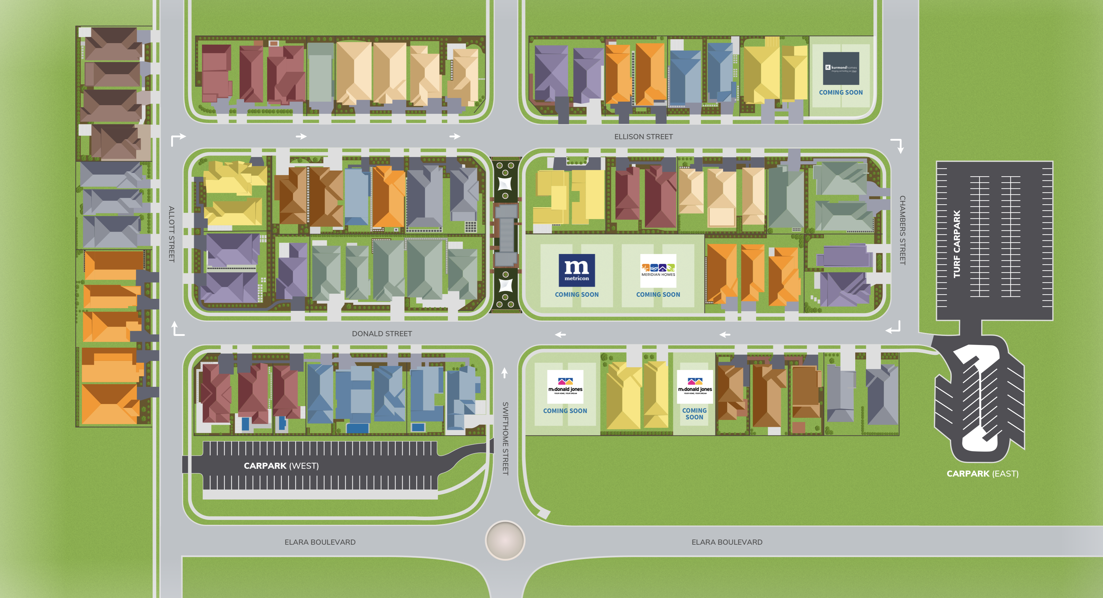
HomeWorld Marsden Park
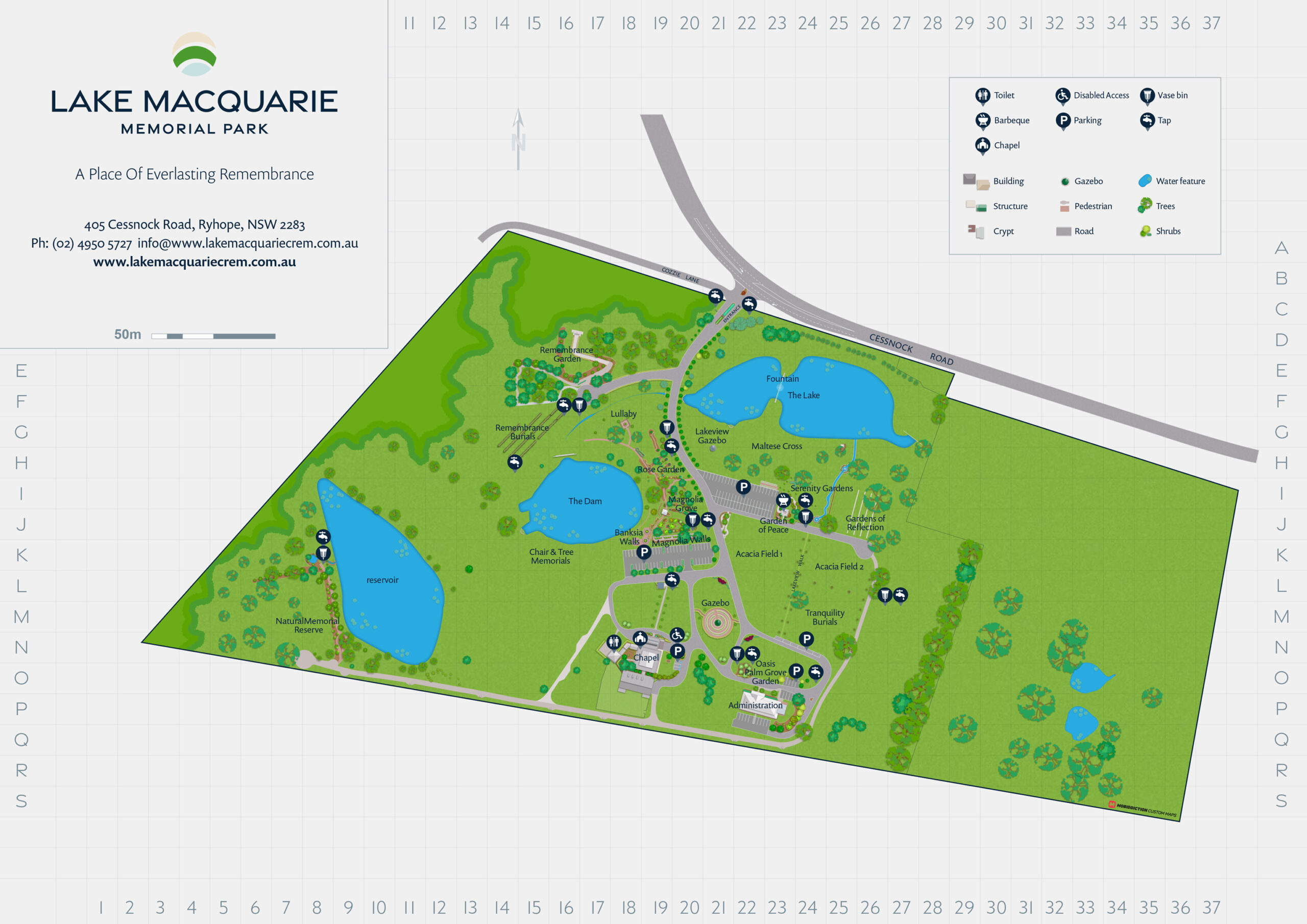
Lake Macquarie
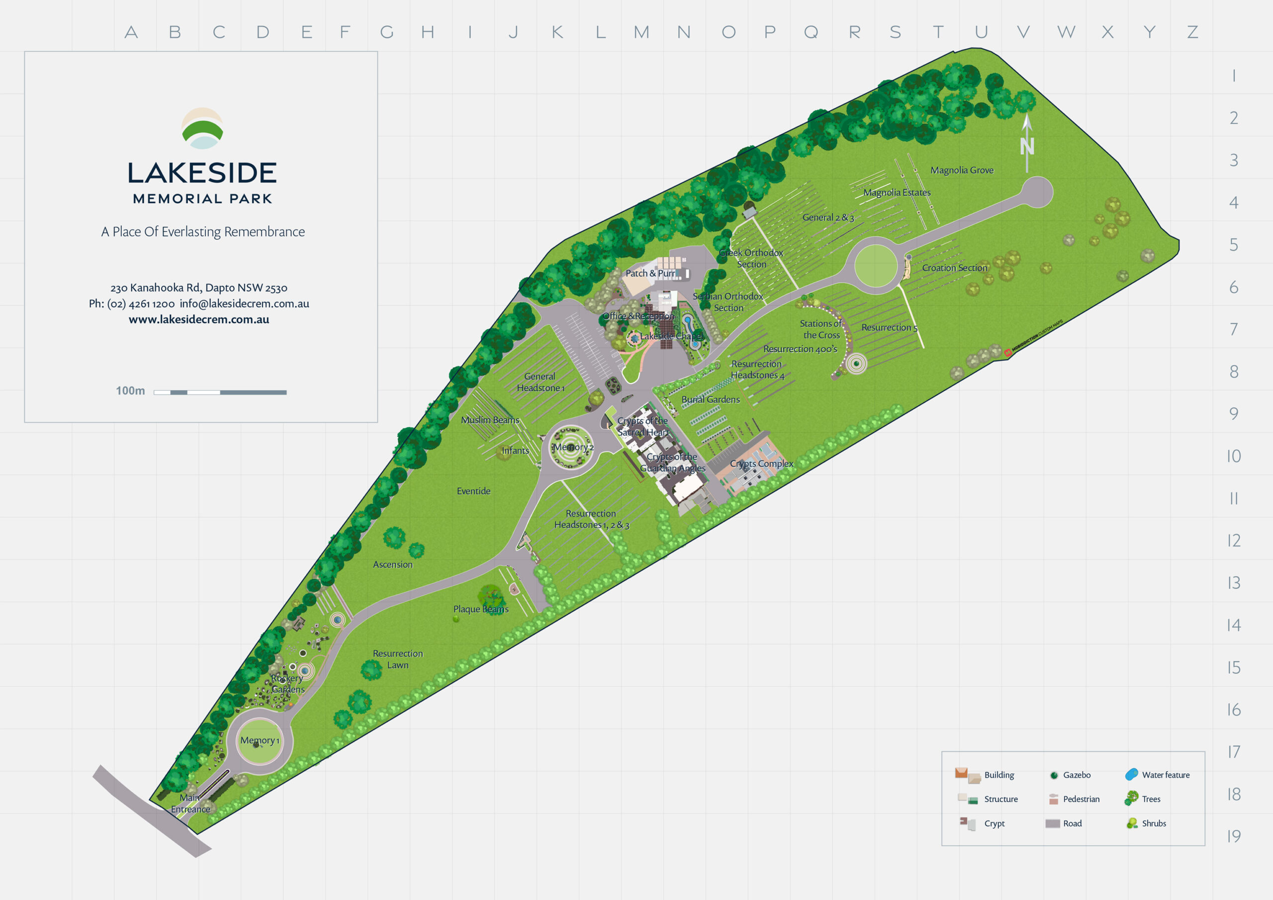
Lakeside
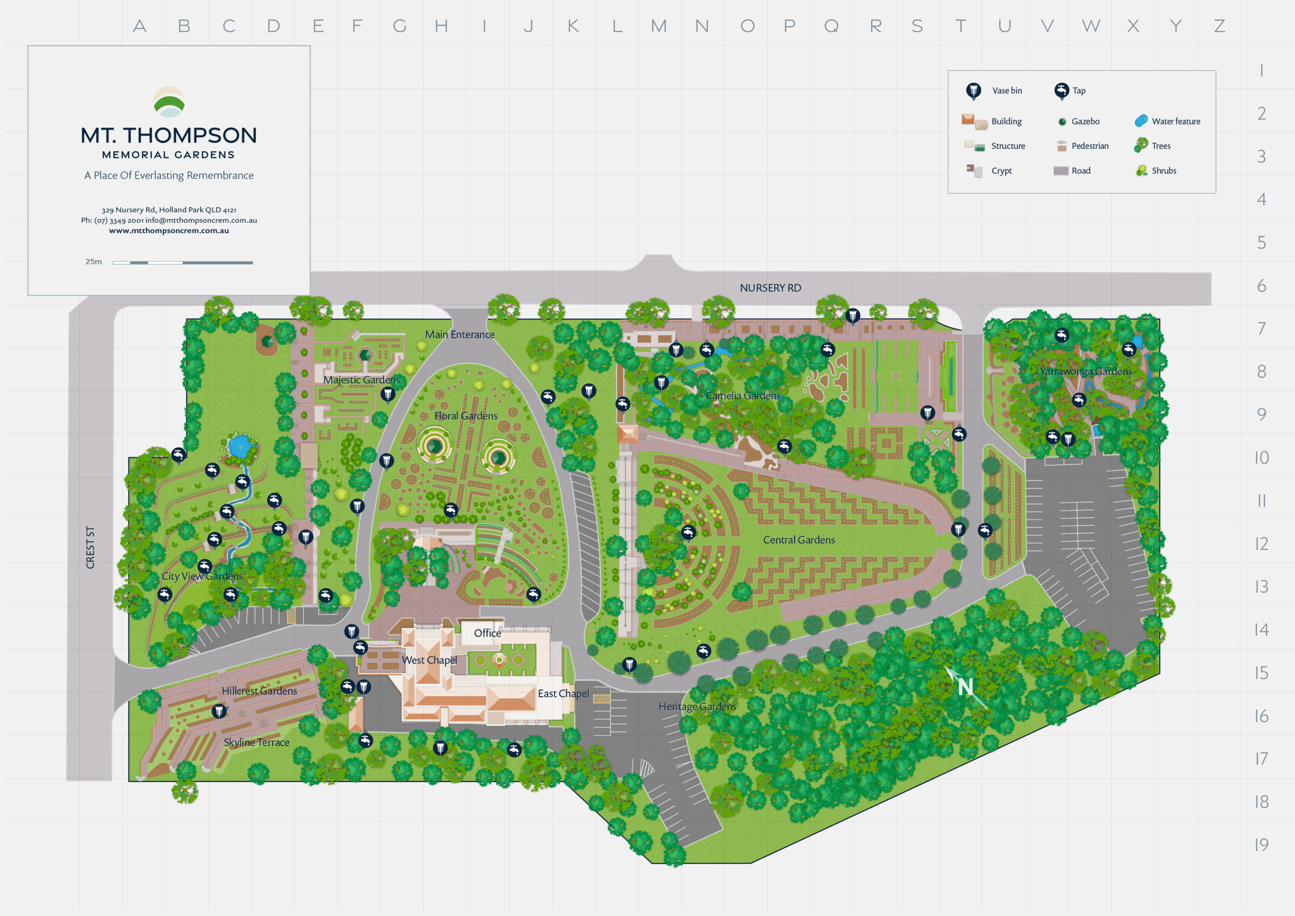
Mt Thompson
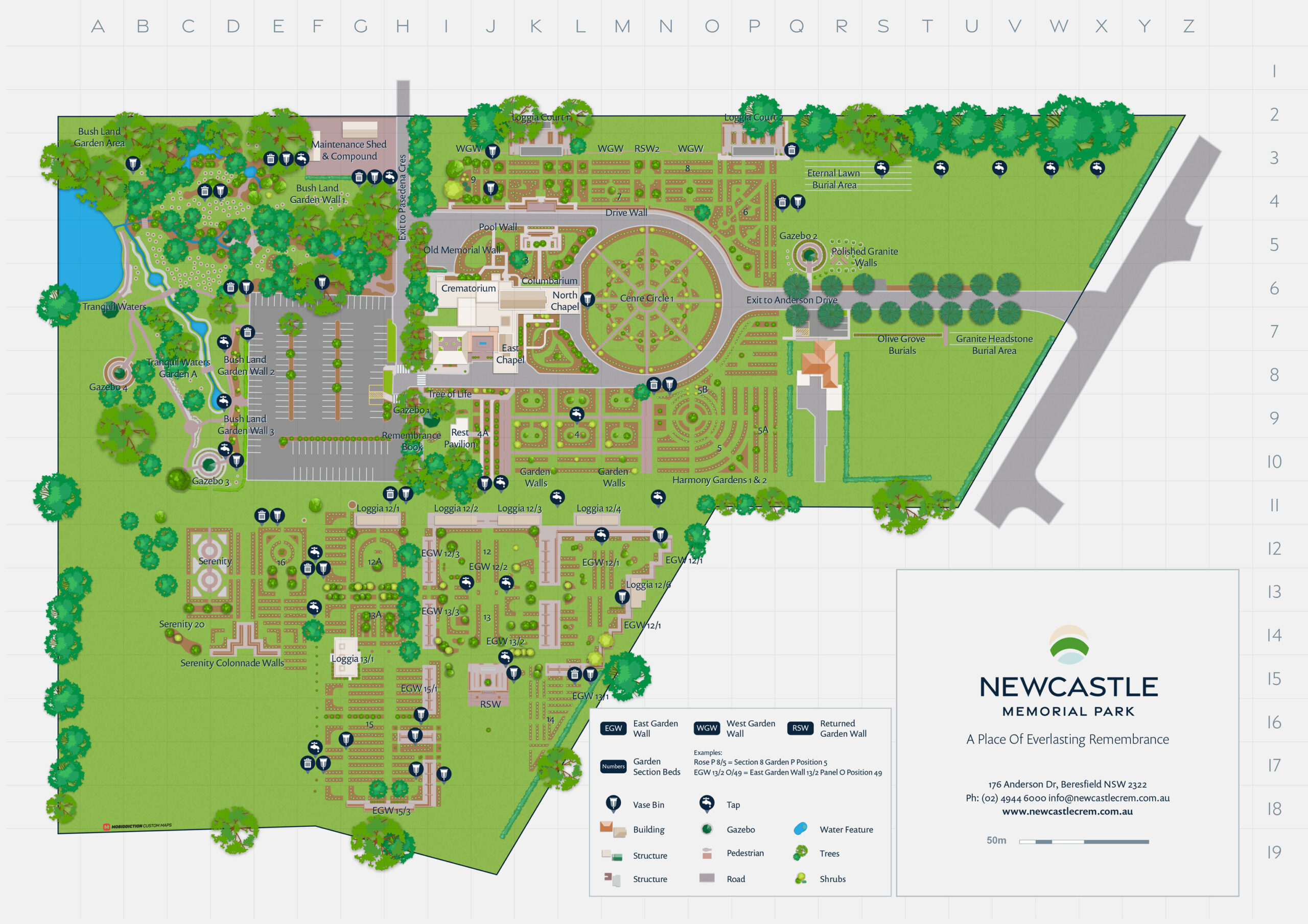
Newcastle
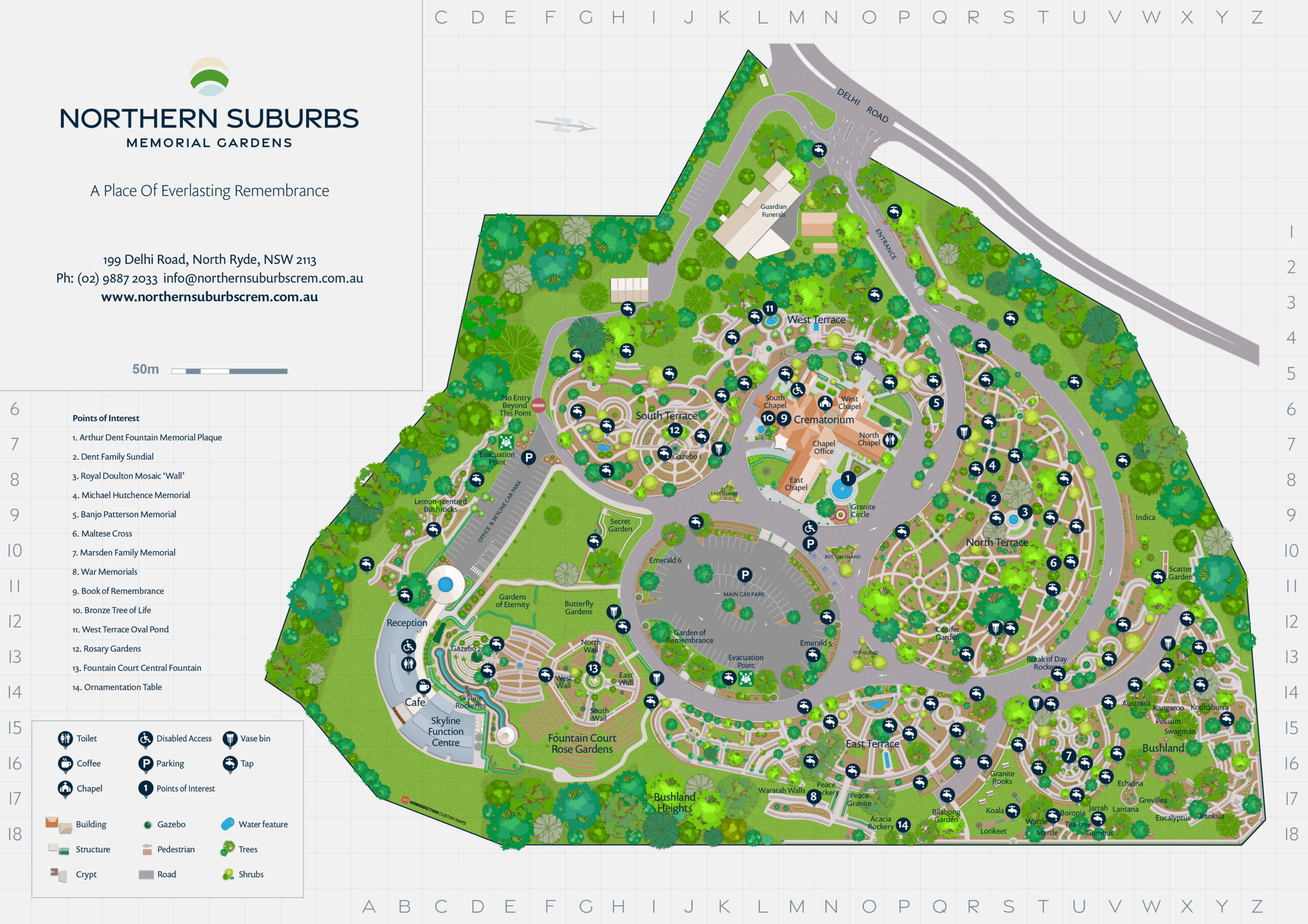
Northern Suburbs
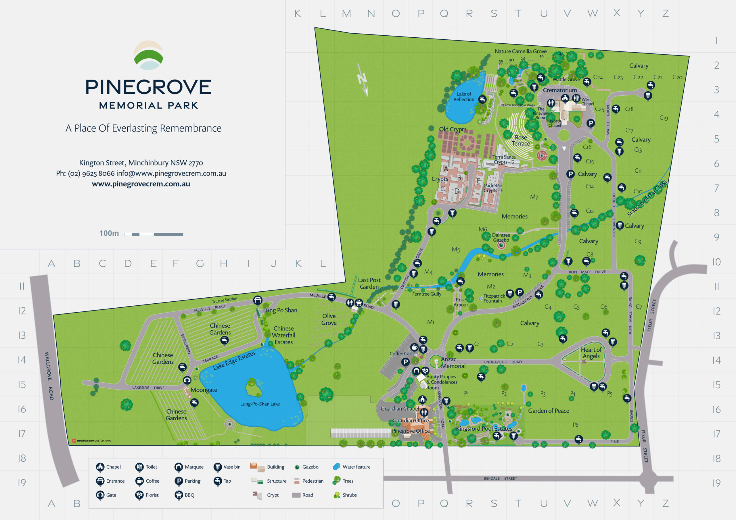
Pinegrove
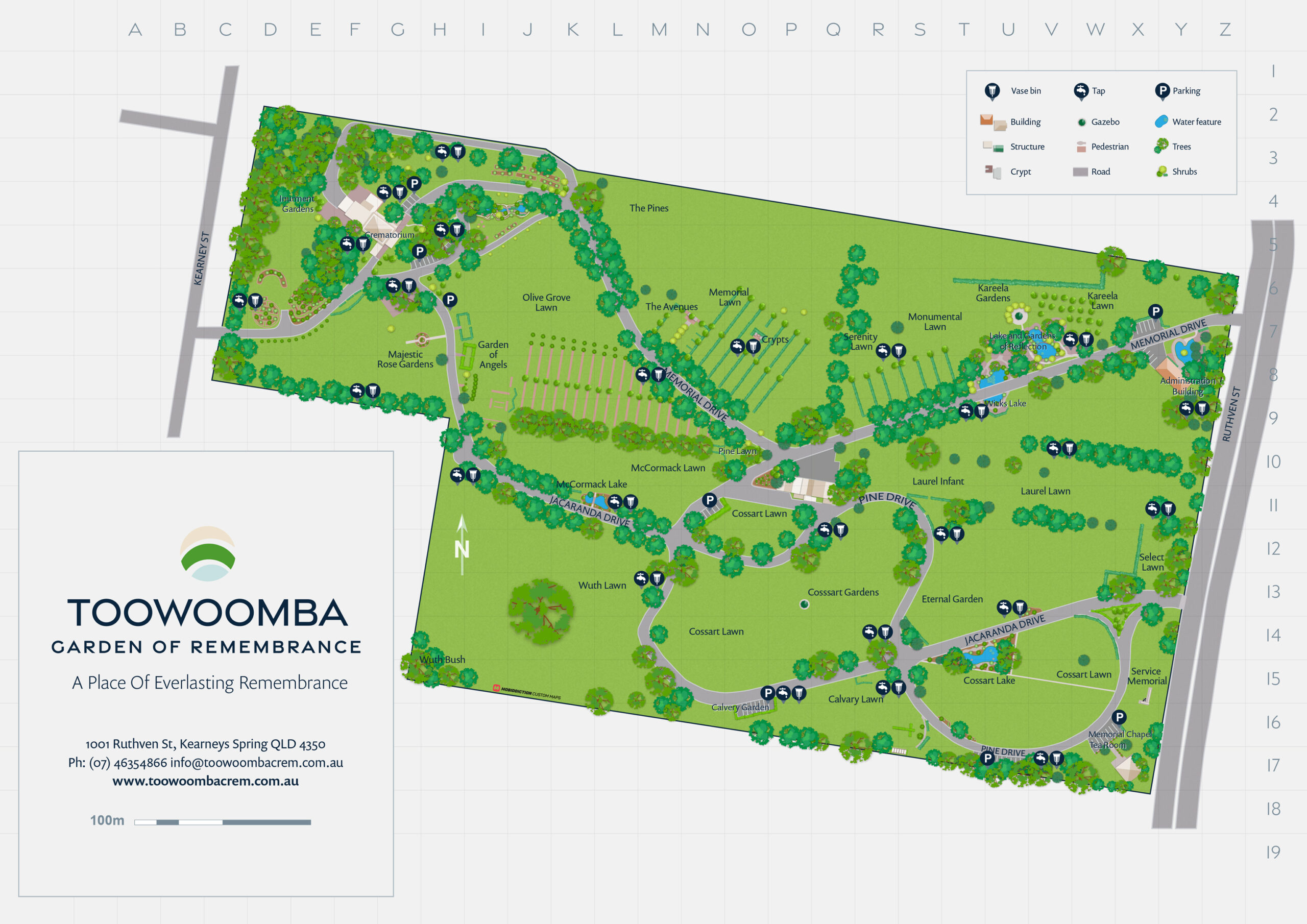
Toowoomba
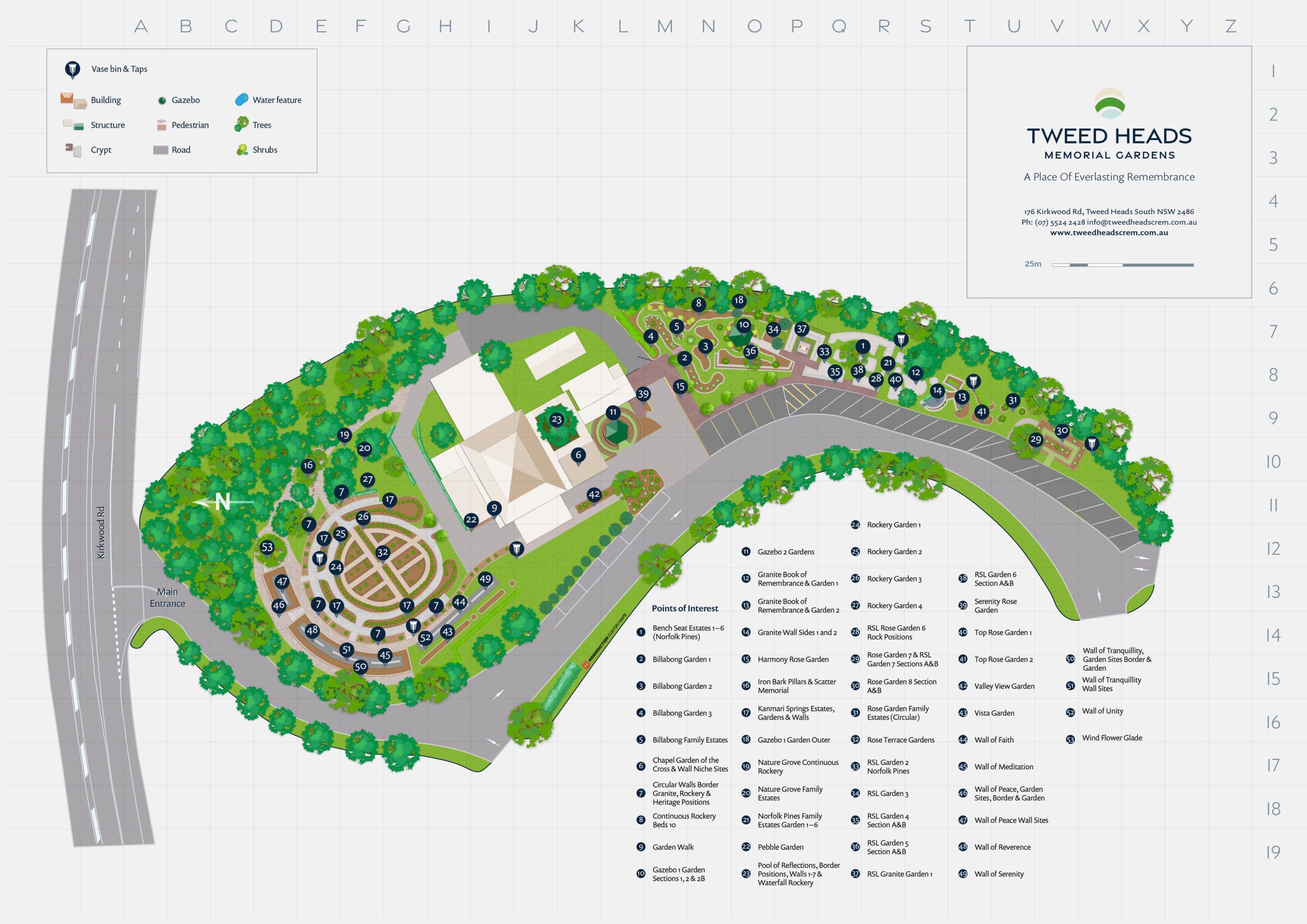
Tweed Heads
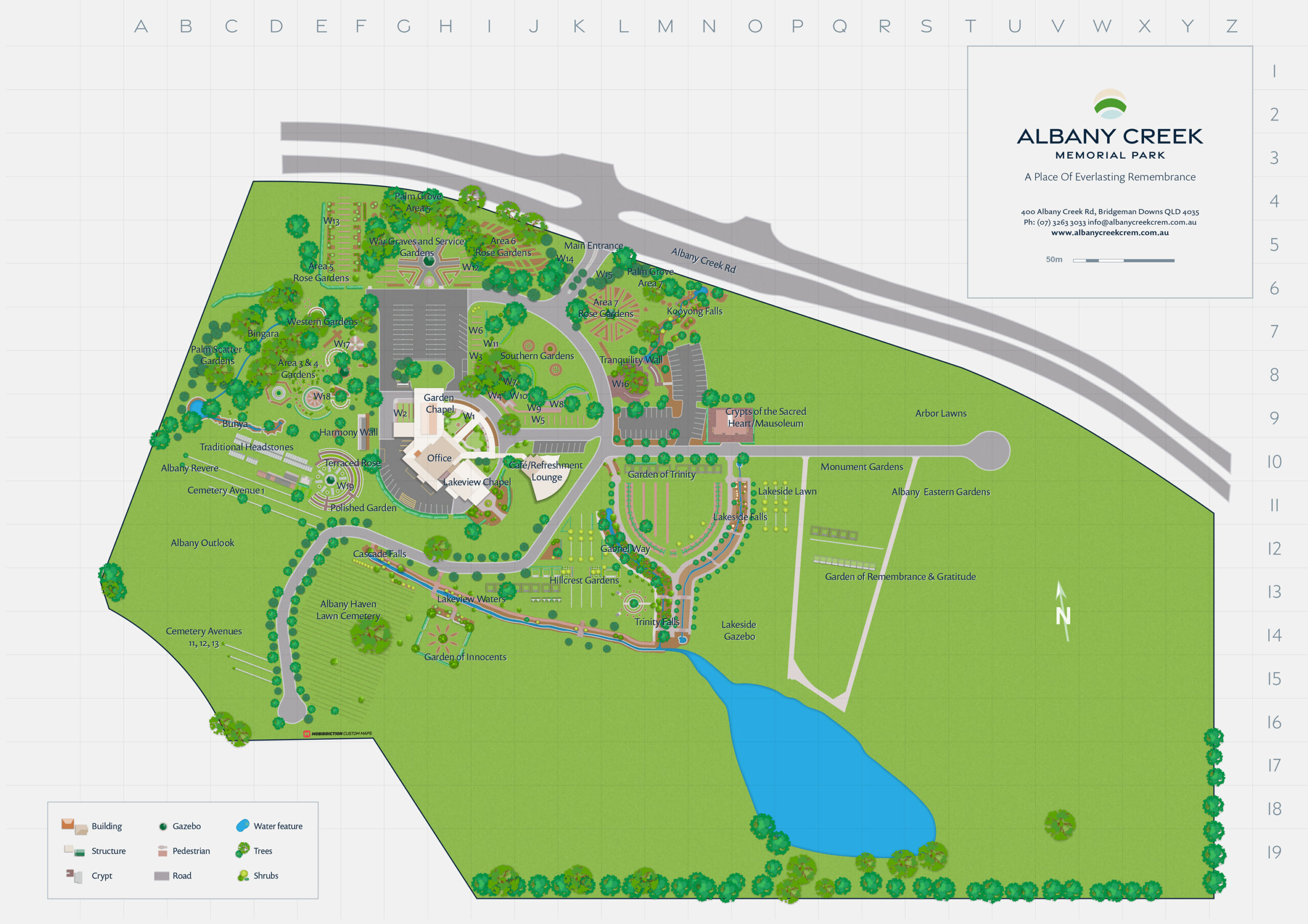
Albany Creek
mobiconnect
Digital Wayfinding
The Scots College
Interested? Shoot us a mail
Δ
Close Menu
Solutions
–
Enterprise Platforms & Software
Business Software Solutions
Custom Enterprise Systems
Integration & API Services
GeoSpatial & Mapping
Digital Mapping & Wayfinding
Geospatial Data Analysis & Visualisation
Location Intelligence Platforms
Drones for Mapping
Venue & Indoor Maps
• Map Gallery
Immersive Tech (VR/AR/XR)
Training & Simulation
VR Experiences
• PatientVR
• RocketCrew
• VapingVR
Interactive Experiences
• Augmented Reality (AR)
• AR WayFinding
• AR Fan Engagement
AI & Consulting Programs
AI for Business
Technology Consulting
Automation & Intelligent Workflows
Resources
What are custom maps?
What is WayFinding?
Types of Custom Maps
Drone Mapping
Map Gallery
–
Featured
Memorial Parks
Easter Show
WayFinding
SharkSmart NSW
Products
–
Powered by Mobiconnect™
PatientVR
Mapiddiction
Jobiddiction
–
Featured
Components
Government
–
Working With Government
Beach Safety
Forest Management
Recreational Fishing
Marine Management
Farming Support
State Forests
Surveying & Mapping
Whale Watching
–
Featured
Working with Government
Industries
–
Enterprise Programs
Healthcare
Finance and Fintech
Memorial Parks
Events & Public Spaces
Sporting Venues
Rewards & Loyalty
Fisheries & Compliance
Retail & Customer Experience
Agritech & Farming
–
Featured
Rewards & Loyalty
Fan Engagement
Case Studies
–
Featured Programs
Our Work
Strategic Government Programs
GeoSpatial & Mapping Platforms
Immersive Tech Innovations
Enterprise Digital Transformation
Healthcare & Patient Outcomes
–
Featured
Platform
Spatial
About Us
Menu Item
Why us?
Our Approach & Strategy
Long Term Programs
Security & Compliance (ISO 27001)
Innovation and R&D
Enterprise Operations & Support
Team & Operations
Our Leadership Team
Careers
–
Featured
Our Expertise
About Us


