Custom Maps are required for many reasons such as for private venues, outdoor areas, private areas, factory floors, golf courses, zoo, parklands, bike paths, walking trails, resorts, outdoor and indoor events. This list can be endless as a map is one of the key things that a user expects and most of the maps either are hard to design or hard to navigate.
AWARD WINNING PLATFORM • BUILT IN AUSTRALIA
Creating your own custom maps got easier.
Cancel anytime. No Credit Card required.

Ideal for private venues, events, factories etc.
Now, it is easier for you to create custom digital maps that work and look great too!
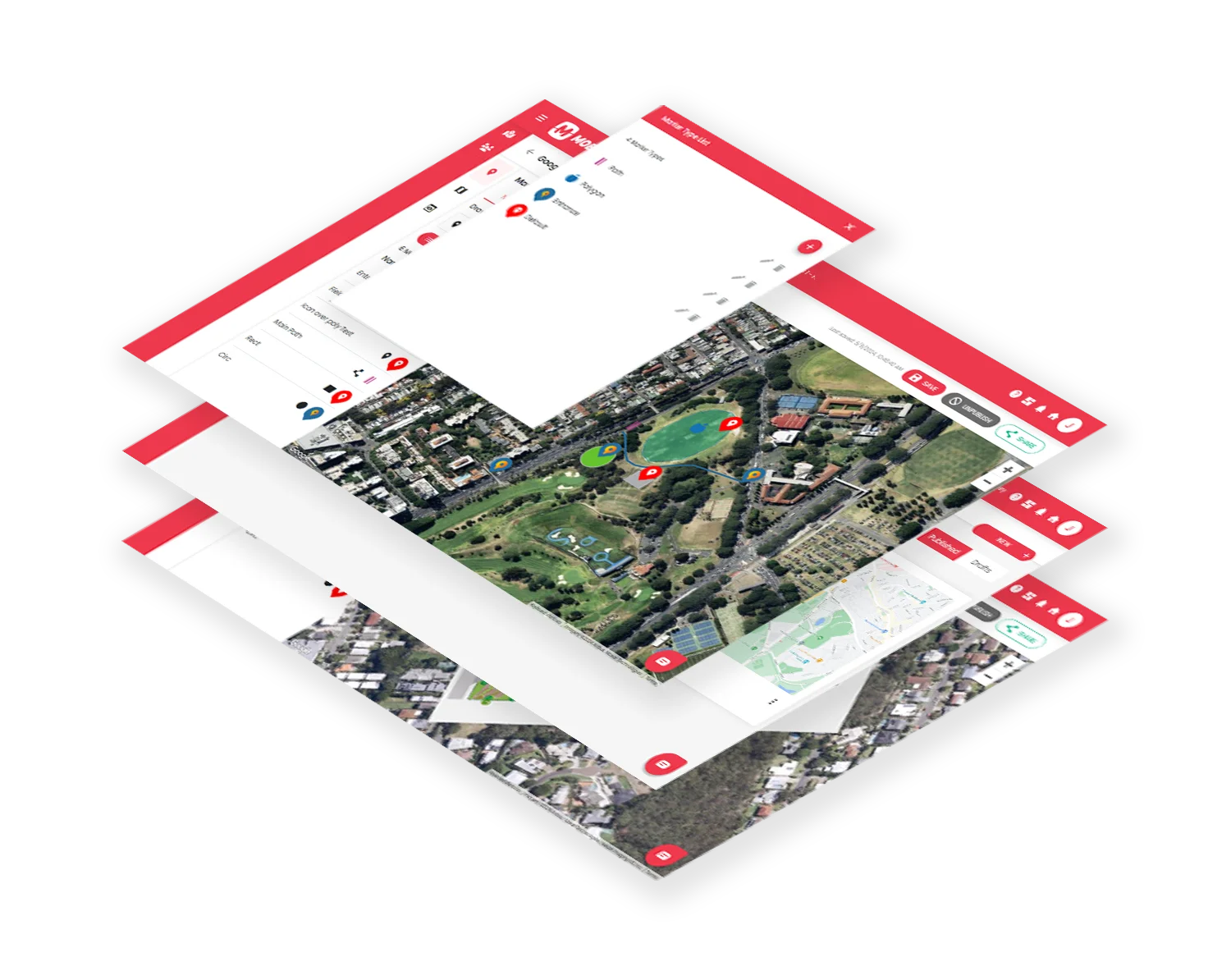
Step 1: Choose the type of map you need
Step 2: Customise your interactive map with stylised points of interest and relevant information.
Step 3: Publish and share your map effortlessly.
It’s that simple. And with our user-friendly interface powered by Mobiconnect™ mapping engine crafted by our team of GIS experts. You can easily make ongoing updates as needed.
Packed with features
Add customers, pics and audio to POIs
There are also options to customers to a particular point of interest and add photos, videos, audio files to each POI (point of interest).
Embed onto your website, digital screens and Apps
You can even generate a link that lets you embed your custom map with the option of showing or hiding filters.


Generate QR codes for POIs
Everyone loves QR codes these days, and you can create QR codes for each point of interest. For example, if you are a resort facility and want a QR code created for one of the areas within a large precinct and point your customers to that area you can do so by creating a QR code of that point of interest.
Share Maps
Publish your custom maps once you’re happy with it. Make changes on the go, and there is an ability to share your maps with your customers through a link or even a text* message.
*Twilio account required for SMS.
Types of Custom Maps you can create
Option 1: Google Map base with annotated POIs, shapes and lines
These are great for when you need to show your venue in the context of its larger geography but need more detail that Google Maps provides.
If Google Maps directions gets people to your street address, but doesn’t then get them the final distance to the place they want to be at your street address, this is the map type for you. You use this when have places visible on Google Maps, but where you want to highlight specific features or points or shapes that Google Maps leaves out. You might need to show details like building outlines, entrances, exit points, where reception or loading docks are carpark entrances and customer parking areas as a few examples.
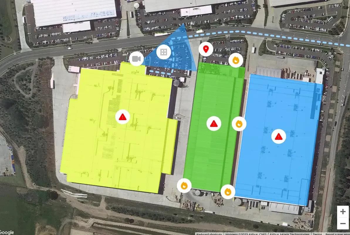
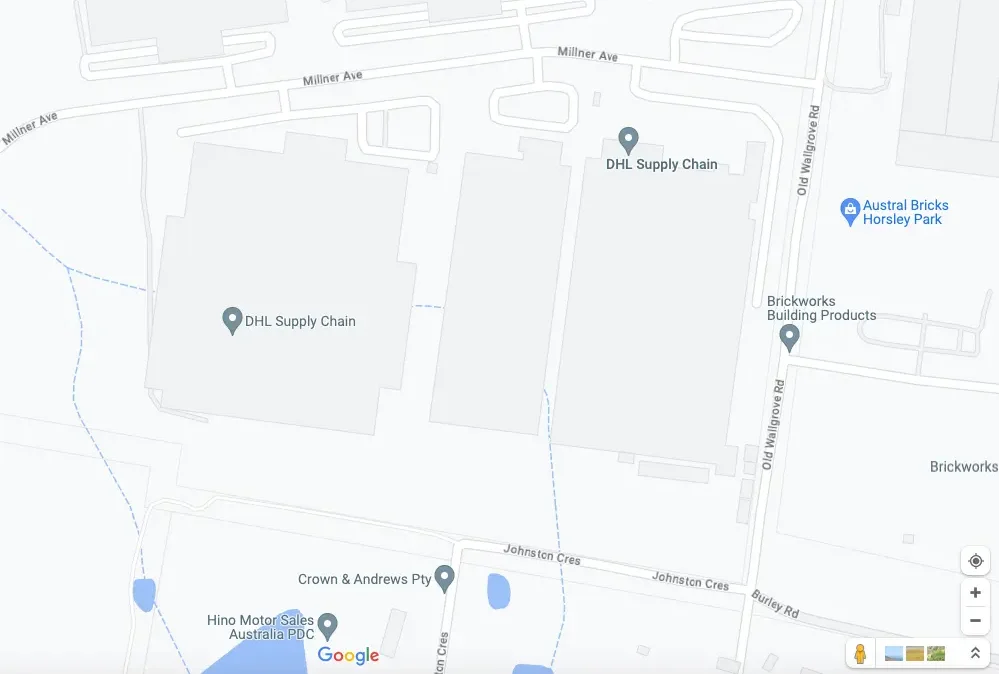
Buildings, entrances, exits, and route highlighted over a Google Map Satellite view
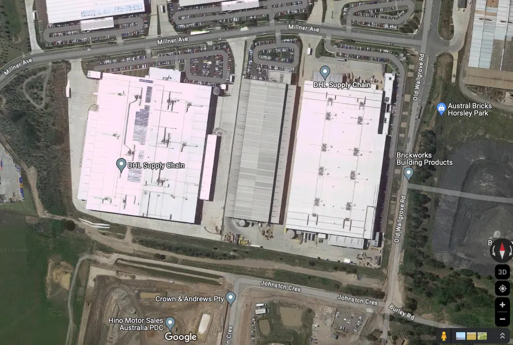
The same Google Map satellite view without site specific annotations
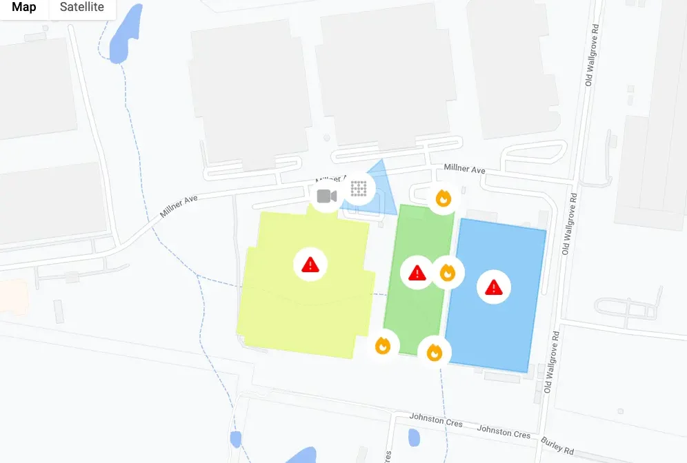
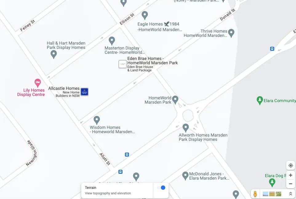
The site specific annotations over a Google Map street map view
The bare Google Map street map view of the area
Option 2: Overlay your design onto a Google Map
Add your own design and replace the area of a Google Map. This is a bit technical but will give you an amazing way to replace a section on Google with your own. Your designer can create a map which is built to scale, you then align that onto Google with the help of our platform and replace the section as your own custom map.
This map type requires a high-resolution image with some specific requirements in its production to work properly. Use this where you want to customise the style of your venue, and still want to display markers, shapes (rectangles/circles/polygons), and lines (routes or boundaries). Your custom map image will give way to the underlying Google Street or Satellite view base behind it’s edges.
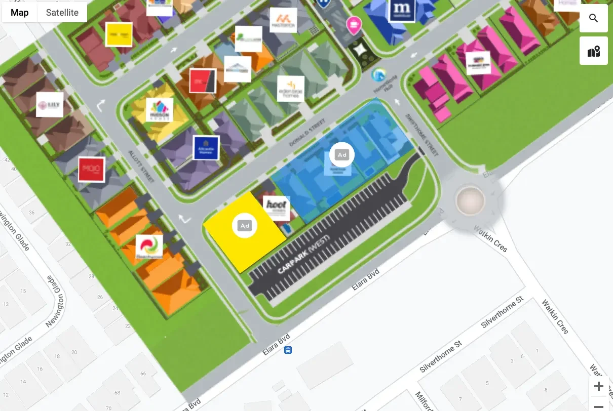
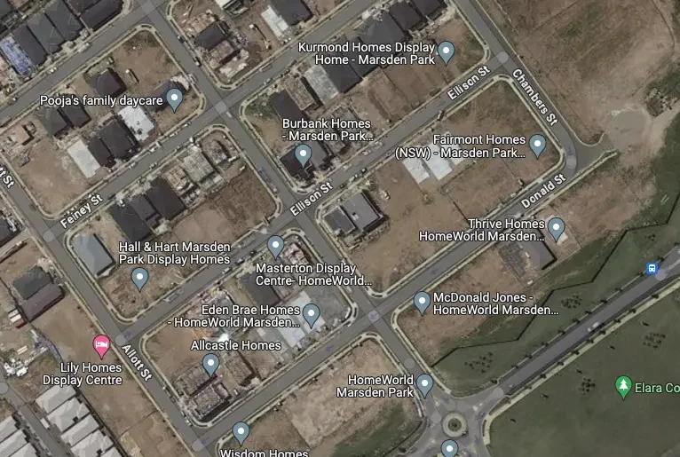
A Home Display Village custom map
The Display Village Google Street Map view
A Home Display Village custom map
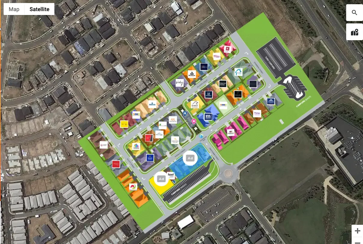
The out of date Google satellite imagery
Option 3: Private maps with no underlay Google Map
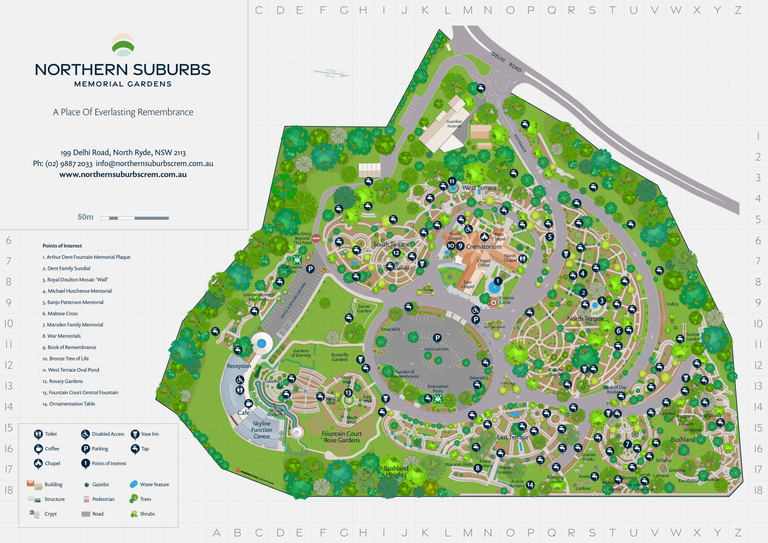
This is great when you have a base design such as a .png file and want to digitise the map such as a zoo, festival, event map or a factory.
This option does not have a google map underlay and helps you digitise your map design. These are for when GPS tracked locations are not needed or not available, indoor maps often use this type because your phone’s GPS doesn’t often work inside buildings.
These are also used when stylised representations of the map are more useful than exact representations of real work shapes and geometry. When the order and relative positions of place or features on the map are more important than exact angles and distances, stylised maps can sometimes provide more clarity and usefulness than maps that reflect the real work more accurately. Train maps are an extreme example of this – where it’s way more useful to clearly show the order of stations and which rail line they lie on, and distances and directions between stations are not nearly as important to people using the maps to get from one station to another.
Use this where you don’t need any underlying geographical or GPS alignment or where your custom map image is stylised and doesn’t directly align with real work geography.
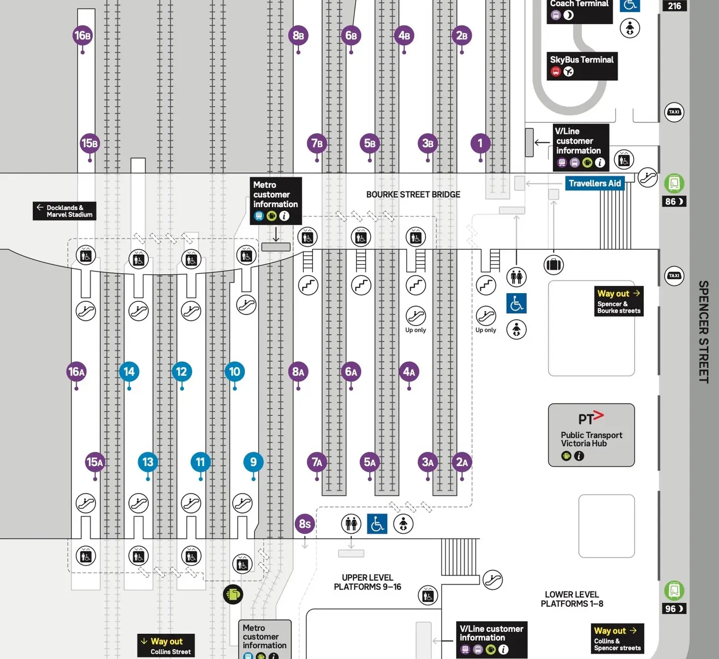
Stylised “logical” map of train station
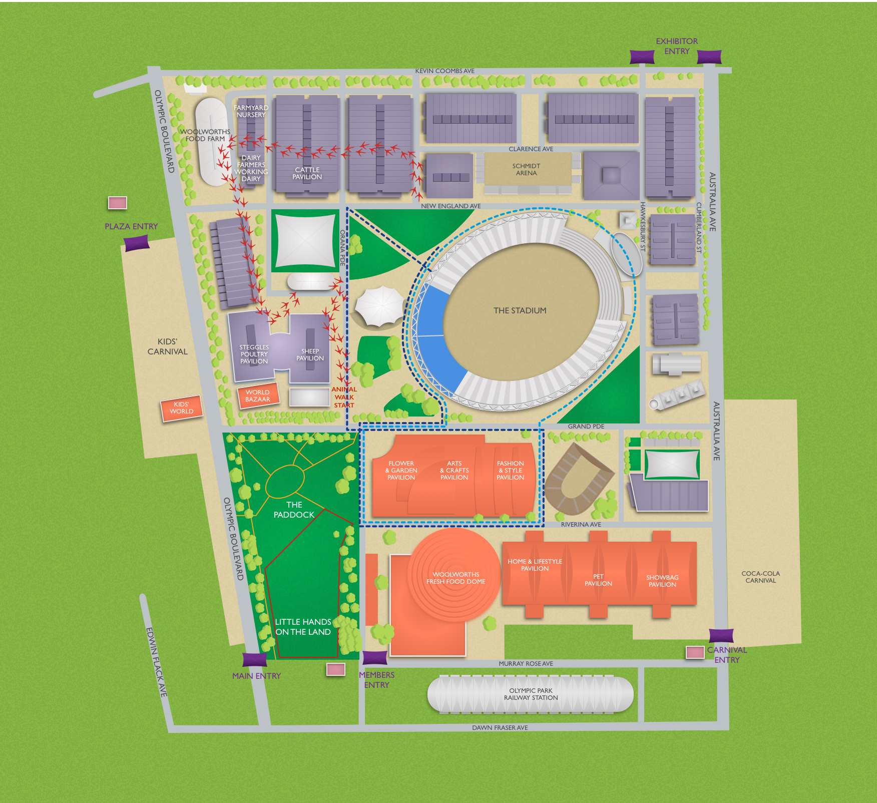
An illustrated map of the Sydney Royal Easter Show
Creating custom Maps is hard. We get that.
Need an enterprise custom map solution?
Some of our clients prefer us to do their maps specially if it is complicated and needs GIS design expertise. Our custom maps specialist team can help, whether it is your own design, and you want us to help or need us to create the full map and help you set up the digital version. Get in touch to find out more about our custom mapping services.
Our enterprise mapping team builds custom Maps, these include example such as enhancing outdoor events by overlaying event-specific information. Ideal for showcasing details like those designed for Sydney’s Royal Easter Show Maps including optional walking directions. Versatile use across various channels: websites, apps, and even large onsite displays, they can also be used in printed or PDF flyers. Capability to include private walking directions, beneficial for resorts, golf courses, zoos, factory floors etc. These helps visitors navigate specific locations, such as finding the Gorilla enclosure in a Zoo or Zone B, Section 1 in a factory which is not that user friendly when it comes to visitors on site.
We are here to help.
Get set up in just a few minutes.
No complicated set up or costs. Get started in a few easy steps.
Live chat customer support.
Reach out for any technical help to our awesome team if you need help.
Powering businesses since 2013.
100% Australian ICT registered service provider since 2013.
Mobiconnect™ is built by the team at Mobiddiction Pty Ltd operating since 2013.