Using specific software and program a pre-flying path mapping tools you can use Drones to create a high resolution map for outdoor venues. You can create a flight path, stitch multiple photos, direction of flight.
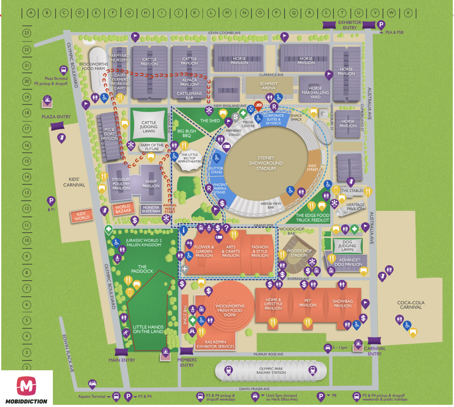
Our expert drone team at Mobiddiction uses Drones to create high resolution maps for custom venues. Here’s how we use Drones for Custom Maps.
We use Software which makes the map uses overlays of different many photos, drone meta data photos embed altitude data, GPS data, compass heading and you feed into this a special software to stitch it into one great big image.
We recently produced a photo in high resolution 18,000 x 12,000 pixels and created overlay map tiles and the map was used in custom map created with high resolution way finding points.
So, when you do not have Google Maps or Apple Maps or any other map for your private venue you can fly drones and create high resolution outdoor professional maps.
Note of caution: Drones or remotely piloted aircraft (RPA) can seem to be fun, and yes they are but Drone safety rules are to be followed at all times when you fly a drone. There are Drone safety apps and you can download a CASA-verified drone safety app to ensure you are doing the right thing. Safety while flying drones is very important. Make sure you are aware of the rules such as CASA restrictions on flying drones. It is illegal to fly drones without a license or permission in many places.
