Mobiddiction delivers spatial platforms, mapping tools and location aware applications for government and enterprise clients that rely on accurate, current and easy to use geospatial data. Our work spans operational field mobility tools, public facing maps, venue navigation systems, spatial data integration and long term geospatial programs that support business and regulatory needs.
Australia Geospatial &
Mapping Experts

GeoSpatial & Enterprise Mapping programs
Modern Spatial Platforms
Backed by Practical Delivery
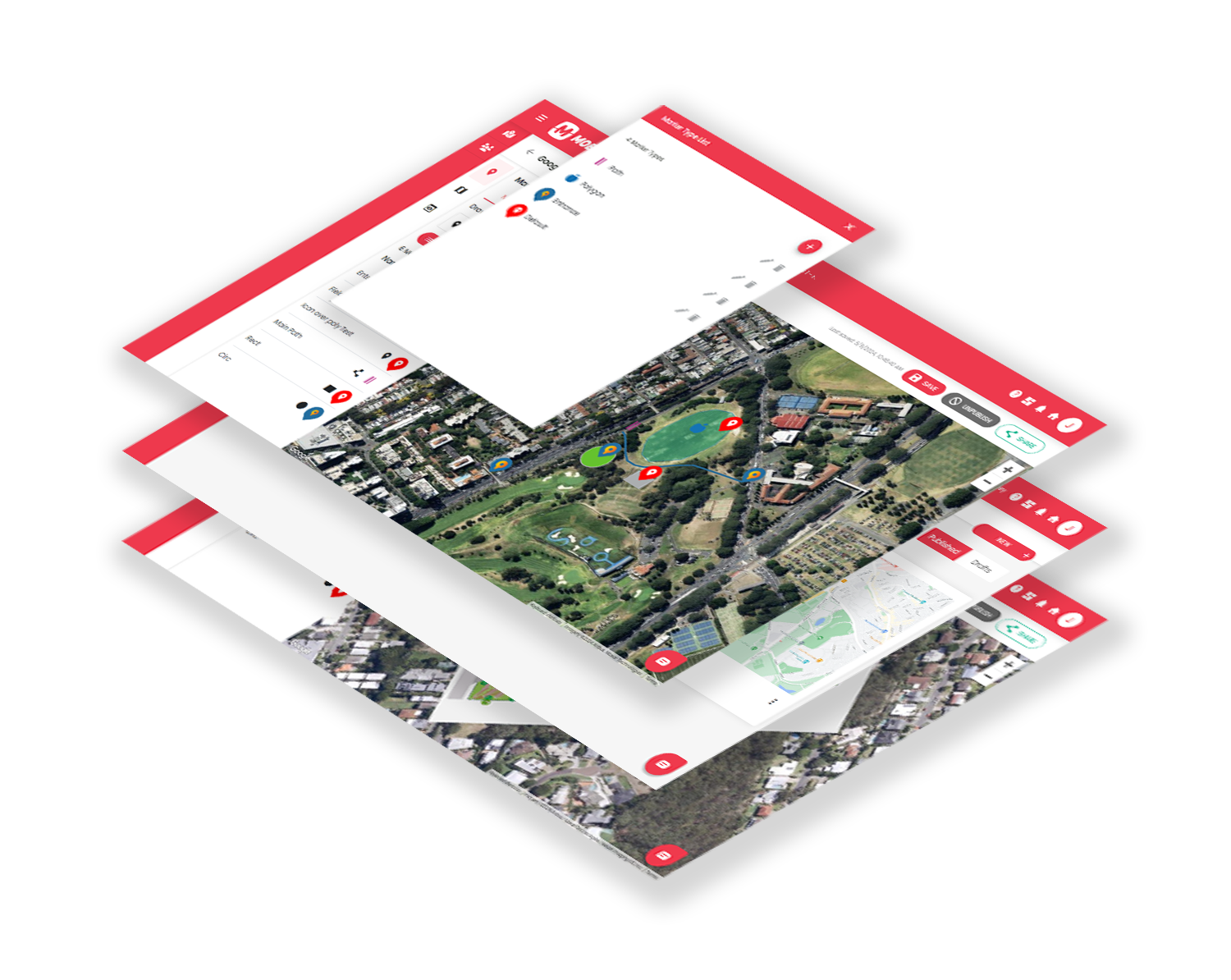
We design and support digital mapping systems that combine dependable data pipelines, cloud services, spatial APIs and well designed interfaces. Our work includes large public venues, regulated environments, infrastructure planning tools, agricultural operations, visitor navigation and consumer facing maps. We work extensively with ESRI ArcGIS, custom APIs, geolocation services, MapBox, high accuracy GNSS receivers and cloud based spatial services.
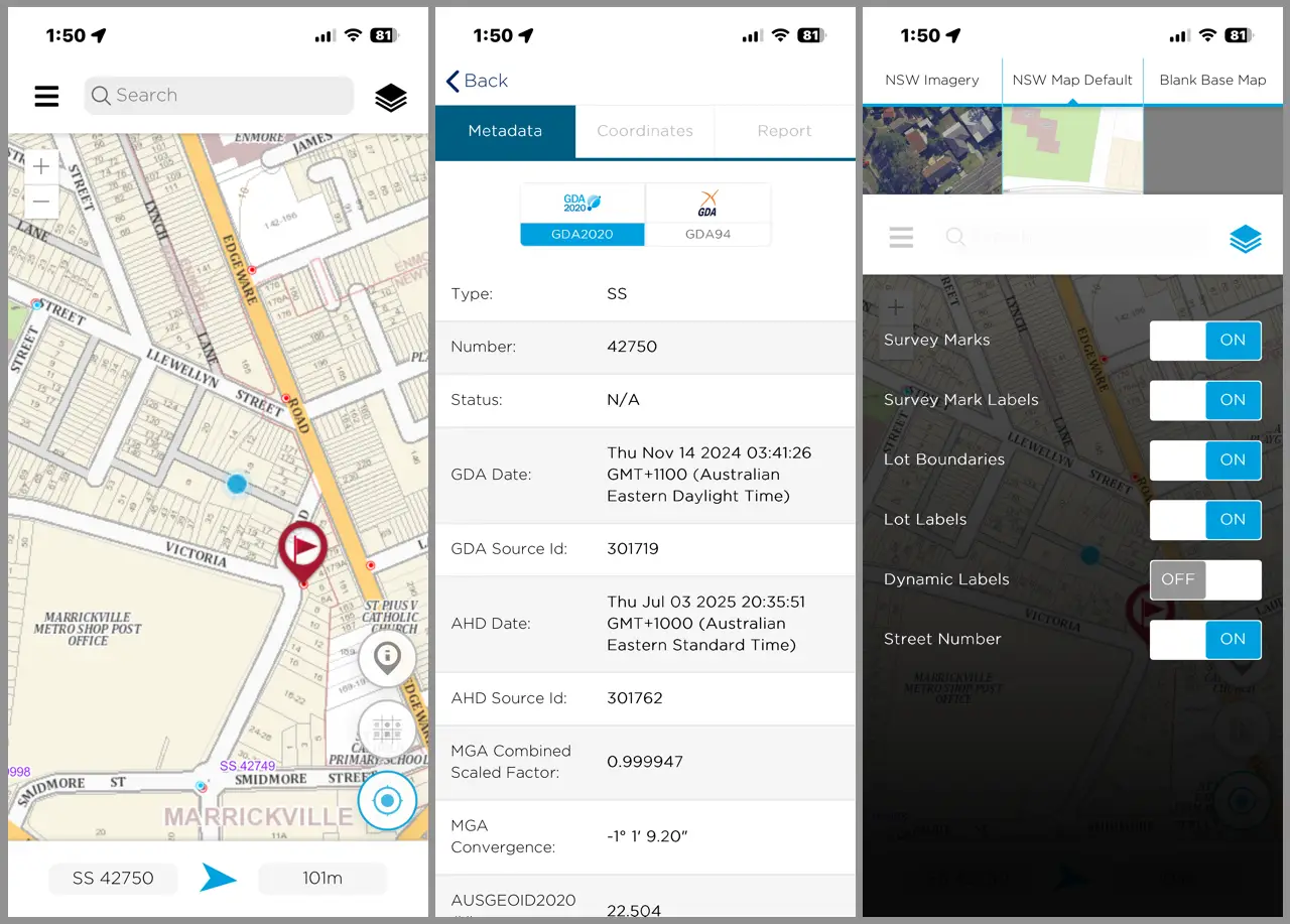
Our experience also includes a long term partnership with NSW Spatial Services on the NSW Survey Marks program, where we helped surface complex geodetic data for industry professionals and the public.

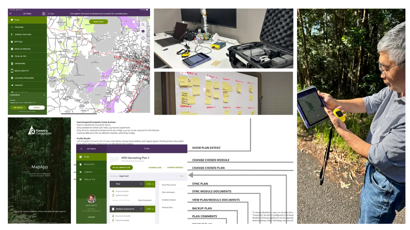
For Forestry Corporation of NSW, we support a field platform that integrates ESRI ArcGIS services and high precision RTK GNSS receivers. Operators use it to view boundaries, zones and planning layers while working in the field. The app includes a dynamic boundary warning system that alerts operators as they approach harvesting limits, helping maintain compliance with EPA requirements. It can sync in connected areas and then continue to operate offline with accurate boundaries and maps.
Field Mobility Tools
For Regulated and Operational Environments
Mobiddiction builds field mobility tools that support staff working in remote, distributed or regulated environments. These tools combine real time positioning, offline capability, spatial overlays and tight integration with enterprise systems.
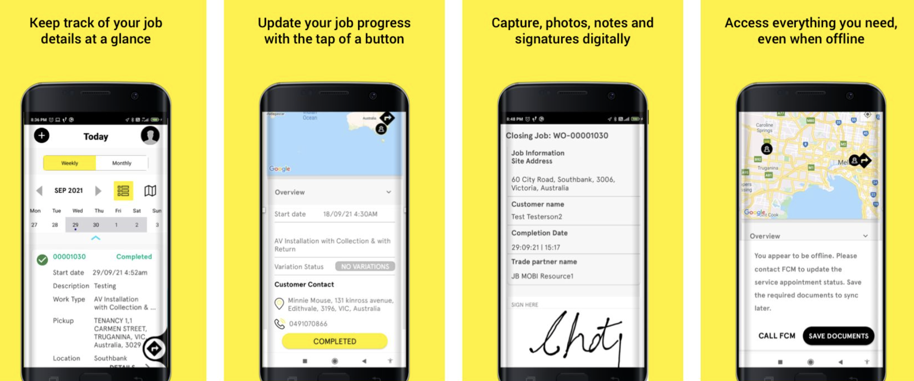
For JB Hi Fi, we created a field mobility tool for technicians installing equipment in homes and offices. It integrates with customer service systems through APIs and provides real time location tracking, job status updates and call masking. It uses geolocation and spatial data to guide technicians through required steps and prevents departures before the correct approvals and signoffs have been captured.
Public Safety
Consumer Mapping Tools
We build mapping platforms for agencies and consumer facing programs that rely on accurate geospatial data and reliable delivery.
FishSmart gives recreational fishers access to localised rules and regulations based on their current location, including zoning and area based restrictions. The mapping uses DPIRD Fisheries MapBox and MapBox Studio as the source of truth for regulation and spatial information.

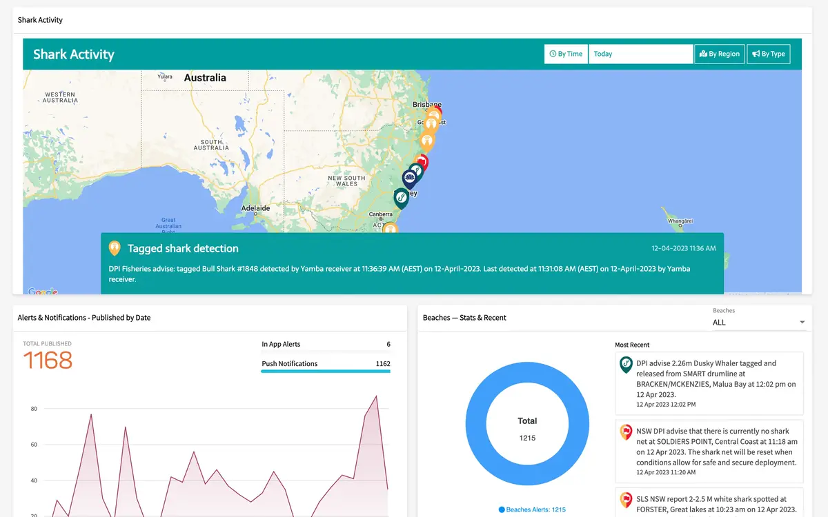
The SharkSmart program uses mapping and real time shark detection APIs to provide the public with access to tagged shark detections, beach safety alerts, and shark safety and risk reduction information. It integrates multiple shark information data sources including tagged shark detections, drone operations and sightings, SmartDrumline operations, shark netting operations, and it provides DPIRD Fisheries with a fast and reliable incident management and public communications channel.
For the Royal Melbourne Show and the Sydney Royal Easter Show, we delivered visitor maps with real time updates and AI powered wayfinding that helps users navigate through temporary routes and attractions.
These platforms supported more than one hundred thousand users during each event and remained stable under peak load.
We also provide monitoring and technical support during peak periods and on ground support team where required.
Large Venue Mapping
Event Wayfinding
Mobiddiction creates dynamic maps and navigation systems for major events that need to adapt to temporary infrastructure, crowds and rapidly changing event schedules or conditions.
Drone Capture
Aerial Photography and Site Mapping
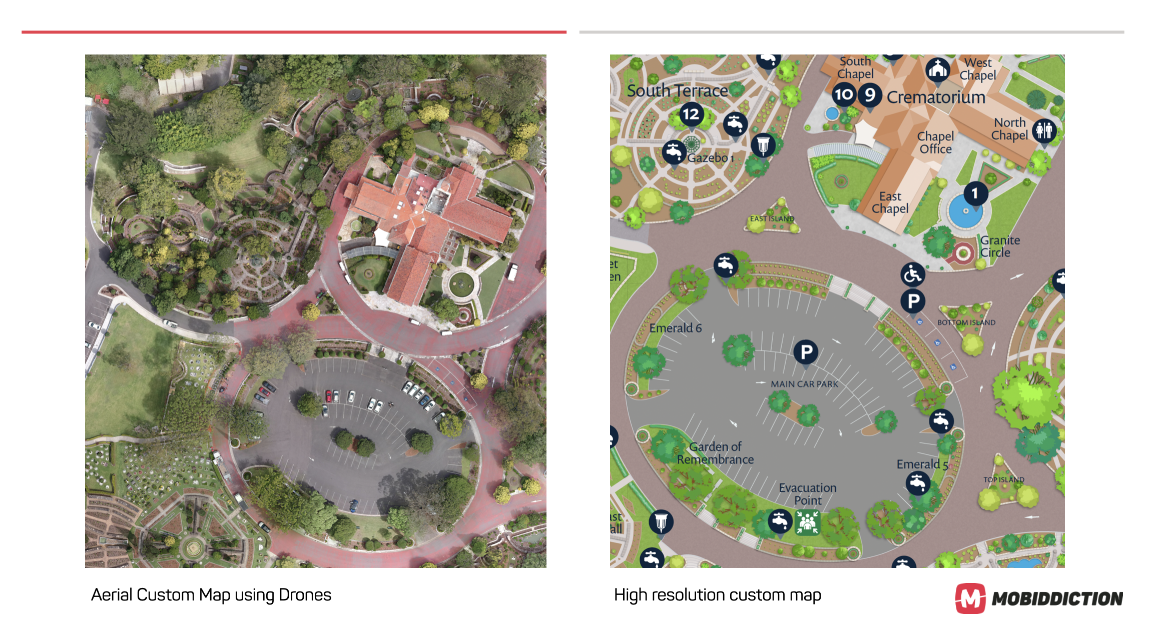
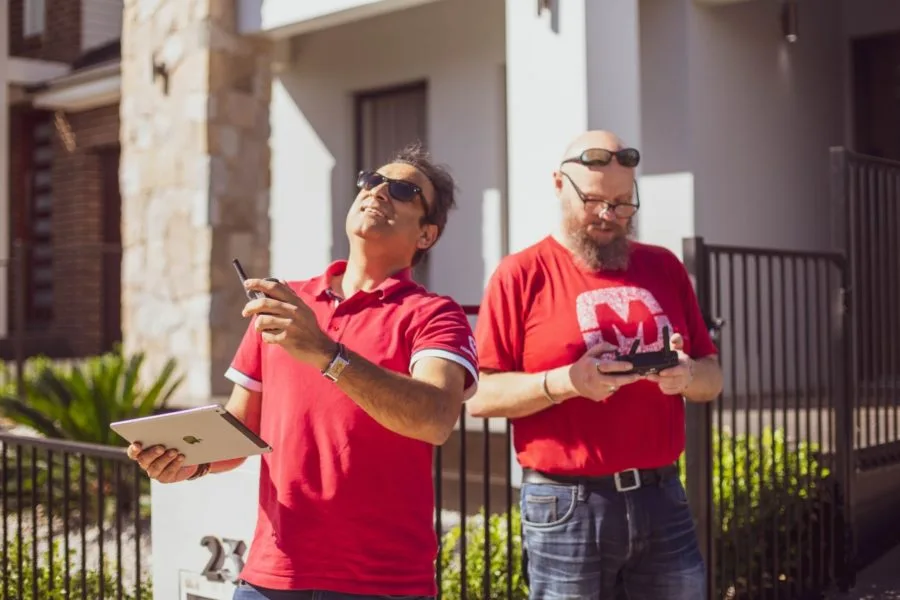
When clients require updated or highly accurate site maps, we operate drone and aerial capture programs to produce current spatial data. This supports baseline maps, measurement workflows, planning overlays and consumer facing applications.
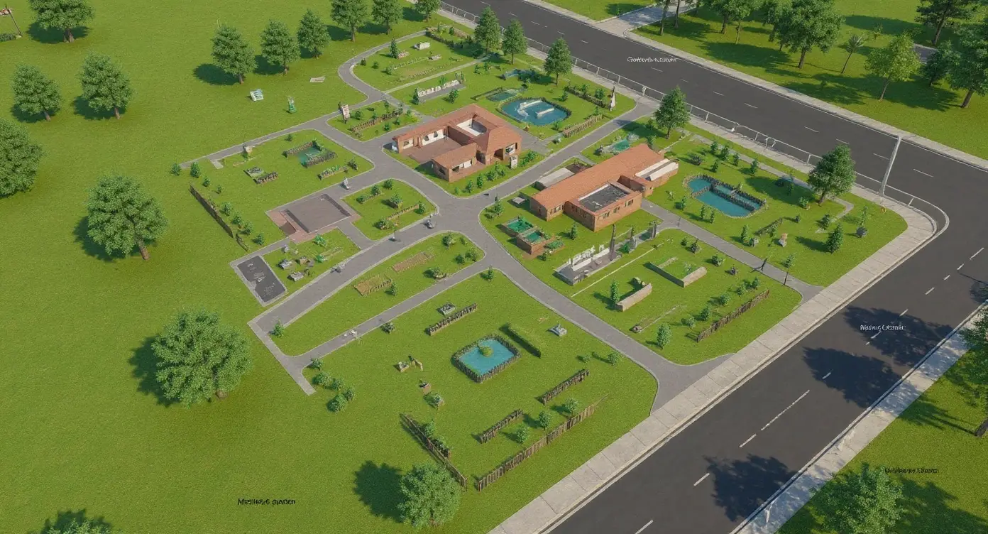
Invocare Group engaged us to produce new maps for 14 cemeteries and memorial parks across NSW and SE Qld. By using the same capture and processing approach at each site, we delivered a consistent experience across all venues and reduced the time required and overall cost of producing high quality maps.
We also applied similar methods for HomeWorld to create accurate maps of display villages, supporting customer wayfinding and operational planning.
A Practical Partner for
Geospatial Delivery
Our spatial capability covers the full lifecycle from capture through to external system API integration and map hosting and delivery. We combine GIS specialist, software developers, UX designers, cloud engineers and mapping specialists who understand the operational realities behind every map. We support long term spatial programs, field mobility tools, public facing maps and enterprise GIS workflows across a range of industries.
Whether you need a modern mapping interface, integration with your ArcGIS environment, updated spatial data, a field mobility solution or a long term mapping platform, Mobiddiction provides a secure and reliable approach to geospatial delivery.
Modern, Scalable, and Future-ready Geospatial Delivery.
Get in touch for a discovery session with our team. We love tech, but speak human.